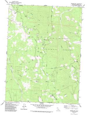
Grouse Mountain Topo Map California
To zoom in, hover over the map of Grouse Mountain
USGS Topo Quad 40123g6 - 1:24,000 scale
| Topo Map Name: | Grouse Mountain |
| USGS Topo Quad ID: | 40123g6 |
| Print Size: | ca. 21 1/4" wide x 27" high |
| Southeast Coordinates: | 40.75° N latitude / 123.625° W longitude |
| Map Center Coordinates: | 40.8125° N latitude / 123.6875° W longitude |
| U.S. State: | CA |
| Filename: | o40123g6.jpg |
| Download Map JPG Image: | Grouse Mountain topo map 1:24,000 scale |
| Map Type: | Topographic |
| Topo Series: | 7.5´ |
| Map Scale: | 1:24,000 |
| Source of Map Images: | United States Geological Survey (USGS) |
| Alternate Map Versions: |
Grouse Mtn CA 1979, updated 1985 Download PDF Buy paper map Grouse Mountain CA 1997, updated 2001 Download PDF Buy paper map Grouse Mountain CA 2012 Download PDF Buy paper map Grouse Mountain CA 2015 Download PDF Buy paper map |
| FStopo: | US Forest Service topo Grouse Mountain is available: Download FStopo PDF Download FStopo TIF |
1:24,000 Topo Quads surrounding Grouse Mountain
> Back to 40123e1 at 1:100,000 scale
> Back to 40122a1 at 1:250,000 scale
> Back to U.S. Topo Maps home
Grouse Mountain topo map: Gazetteer
Grouse Mountain: Flats
Buck Flat elevation 1559m 5114′Grouse Mountain: Lakes
Clear Lake elevation 1498m 4914′Mud Lake elevation 1578m 5177′
Grouse Mountain: Mines
Horse Mountain Mine elevation 1296m 4251′Grouse Mountain: Pillars
Black Rock elevation 1480m 4855′Grouse Mountain: Populated Places
Janes Place elevation 919m 3015′Grouse Mountain: Ridges
Ammon Ridge elevation 1446m 4744′Friday Ridge elevation 943m 3093′
Grouse Mountain: Springs
Bottleneck Spring elevation 1516m 4973′Cold Spring elevation 1465m 4806′
White Rock Spring elevation 1528m 5013′
Grouse Mountain: Streams
Barney Creek elevation 773m 2536′Bradford Creek elevation 508m 1666′
Enquist Creek elevation 895m 2936′
Horse Mountain Creek elevation 770m 2526′
Lake Prairie Creek elevation 438m 1437′
Minon Creek elevation 432m 1417′
Packeka Creek elevation 692m 2270′
Panther Creek elevation 477m 1564′
Pardee Creek elevation 488m 1601′
Spike Buck Creek elevation 890m 2919′
Grouse Mountain: Summits
Grouse Mountain elevation 1642m 5387′Horse Mountain elevation 1506m 4940′
Spike Buck Mountain elevation 1661m 5449′
Titlow Hill elevation 1518m 4980′
Grouse Mountain: Trails
Grouse Creek Tractor Way elevation 1499m 4917′Grouse Mountain digital topo map on disk
Buy this Grouse Mountain topo map showing relief, roads, GPS coordinates and other geographical features, as a high-resolution digital map file on DVD:


