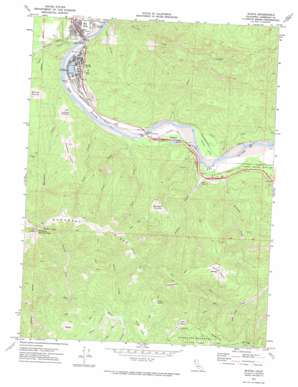
Scotia Topo Map California
To zoom in, hover over the map of Scotia
USGS Topo Quad 40124d1 - 1:24,000 scale
| Topo Map Name: | Scotia |
| USGS Topo Quad ID: | 40124d1 |
| Print Size: | ca. 21 1/4" wide x 27" high |
| Southeast Coordinates: | 40.375° N latitude / 124° W longitude |
| Map Center Coordinates: | 40.4375° N latitude / 124.0625° W longitude |
| U.S. State: | CA |
| Filename: | o40124d1.jpg |
| Download Map JPG Image: | Scotia topo map 1:24,000 scale |
| Map Type: | Topographic |
| Topo Series: | 7.5´ |
| Map Scale: | 1:24,000 |
| Source of Map Images: | United States Geological Survey (USGS) |
| Alternate Map Versions: |
Scotia CA 1970, updated 1974 Download PDF Buy paper map Scotia CA 2012 Download PDF Buy paper map Scotia CA 2015 Download PDF Buy paper map |
1:24,000 Topo Quads surrounding Scotia
> Back to 40124a1 at 1:100,000 scale
> Back to 40124a1 at 1:250,000 scale
> Back to U.S. Topo Maps home
Scotia topo map: Gazetteer
Scotia: Areas
Turner Opening elevation 749m 2457′Scotia: Bridges
Fleisher Memorial Bridge elevation 19m 62′Murphy Memorial Bridge elevation 16m 52′
Scotia: Dams
Scotia Log Pond 205 Dam elevation 42m 137′Scotia: Flats
Barkdull Prairie elevation 529m 1735′Elinor Flat elevation 31m 101′
Giacomini Prairie elevation 405m 1328′
Harrow Prairie elevation 676m 2217′
Hubbard Prairie elevation 833m 2732′
Juhaze Prairie elevation 158m 518′
Snow Prairie elevation 730m 2395′
Scotia: Populated Places
Elinor (historical) elevation 28m 91′Rio Dell elevation 49m 160′
Scotia elevation 59m 193′
Stafford elevation 42m 137′
Scotia: Ridges
Monument Ridge elevation 920m 3018′Peavine Ridge elevation 630m 2066′
Scotia: Streams
Brushy Creek elevation 363m 1190′Dean Creek elevation 23m 75′
Dinner Creek elevation 19m 62′
Greenlow Creek elevation 23m 75′
Harmonica Creek elevation 392m 1286′
Jordan Creek elevation 22m 72′
Kiler Creek elevation 19m 62′
Monument Creek elevation 20m 65′
Nelson Creek elevation 389m 1276′
Pullen Creek elevation 395m 1295′
South Fork Bear Creek elevation 230m 754′
Stitz Creek elevation 19m 62′
Twin Creek elevation 19m 62′
West Fork Bear Creek elevation 272m 892′
Scotia: Summits
Mount Pierce elevation 969m 3179′Scotia: Valleys
Happy Valley elevation 446m 1463′Tank Gulch elevation 32m 104′
Scotia digital topo map on disk
Buy this Scotia topo map showing relief, roads, GPS coordinates and other geographical features, as a high-resolution digital map file on DVD:


