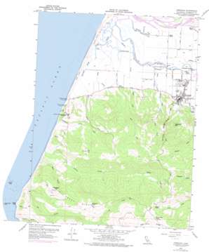
Ferndale Topo Map California
To zoom in, hover over the map of Ferndale
USGS Topo Quad 40124e3 - 1:24,000 scale
| Topo Map Name: | Ferndale |
| USGS Topo Quad ID: | 40124e3 |
| Print Size: | ca. 21 1/4" wide x 27" high |
| Southeast Coordinates: | 40.5° N latitude / 124.25° W longitude |
| Map Center Coordinates: | 40.5625° N latitude / 124.3125° W longitude |
| U.S. State: | CA |
| Filename: | o40124e3.jpg |
| Download Map JPG Image: | Ferndale topo map 1:24,000 scale |
| Map Type: | Topographic |
| Topo Series: | 7.5´ |
| Map Scale: | 1:24,000 |
| Source of Map Images: | United States Geological Survey (USGS) |
| Alternate Map Versions: |
Ferndale CA 2012 Download PDF Buy paper map Ferndale CA 2015 Download PDF Buy paper map |
1:24,000 Topo Quads surrounding Ferndale
Eureka |
Arcata South |
|||
Cannibal Island |
Fields Landing |
Mcwhinney Creek |
||
Ferndale |
Fortuna |
Hydesville |
||
Cape Mendocino |
Capetown |
Taylor Peak |
Scotia |
|
Petrolia |
Buckeye Mountain |
Bull Creek |
> Back to 40124e1 at 1:100,000 scale
> Back to 40124a1 at 1:250,000 scale
> Back to U.S. Topo Maps home
Ferndale topo map: Gazetteer
Ferndale: Areas
Eel River Delta elevation 2m 6′Ferndale: Guts
Centerville Slough elevation 3m 9′Cutoff Slough elevation 3m 9′
East Lake Slough elevation 1m 3′
Morgan Slough elevation 2m 6′
Ferndale: Parks
Fern Cottage Historic District elevation 14m 45′Firemens Park elevation 22m 72′
Humboldt County Fairgrounds elevation 9m 29′
Wreck of Northerner Historical Mark elevation 23m 75′
Ferndale: Populated Places
Arlynda Corners elevation 4m 13′Centerville (historical) elevation 4m 13′
Ferndale elevation 17m 55′
Port Kenyon elevation 4m 13′
Ferndale: Post Offices
Ferndale Post Office elevation 15m 49′Ferndale: Ridges
Bear River Ridge elevation 700m 2296′Oil Creek Ridge elevation 382m 1253′
Wildcat Ridge elevation 263m 862′
Ferndale: Streams
Fleener Creek elevation 1m 3′Francis Creek elevation 3m 9′
Guthrie Creek elevation 0m 0′
Reas Creek elevation 2m 6′
Russ Creek elevation 3m 9′
Smith Creek elevation 2m 6′
Ferndale: Summits
Little Bald Hill elevation 407m 1335′Sugarloaf Mountain elevation 232m 761′
Ferndale: Valleys
Bear Gulch elevation 24m 78′Sleepy Hollow elevation 396m 1299′
Ferndale digital topo map on disk
Buy this Ferndale topo map showing relief, roads, GPS coordinates and other geographical features, as a high-resolution digital map file on DVD:


