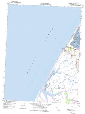
Cannibal Island Topo Map California
To zoom in, hover over the map of Cannibal Island
USGS Topo Quad 40124f3 - 1:24,000 scale
| Topo Map Name: | Cannibal Island |
| USGS Topo Quad ID: | 40124f3 |
| Print Size: | ca. 21 1/4" wide x 27" high |
| Southeast Coordinates: | 40.625° N latitude / 124.25° W longitude |
| Map Center Coordinates: | 40.6875° N latitude / 124.3125° W longitude |
| U.S. State: | CA |
| Filename: | o40124f3.jpg |
| Download Map JPG Image: | Cannibal Island topo map 1:24,000 scale |
| Map Type: | Topographic |
| Topo Series: | 7.5´ |
| Map Scale: | 1:24,000 |
| Source of Map Images: | United States Geological Survey (USGS) |
| Alternate Map Versions: |
Cannibal Island CA 1959, updated 1961 Download PDF Buy paper map Cannibal Island CA 1959, updated 1964 Download PDF Buy paper map Cannibal Island CA 1959, updated 1974 Download PDF Buy paper map Cannibal Island CA 1959, updated 1974 Download PDF Buy paper map Cannibal Island CA 2012 Download PDF Buy paper map Cannibal Island CA 2015 Download PDF Buy paper map |
1:24,000 Topo Quads surrounding Cannibal Island
Tyee City |
Arcata North |
|||
Eureka |
Arcata South |
|||
Cannibal Island |
Fields Landing |
Mcwhinney Creek |
||
Ferndale |
Fortuna |
Hydesville |
||
Cape Mendocino |
Capetown |
Taylor Peak |
Scotia |
> Back to 40124e1 at 1:100,000 scale
> Back to 40124a1 at 1:250,000 scale
> Back to U.S. Topo Maps home
Cannibal Island topo map: Gazetteer
Cannibal Island: Bays
North Bay elevation 0m 0′Cannibal Island: Guts
Hawk Slough elevation 1m 3′Hogpen Slough elevation 1m 3′
McNulty Slough elevation 0m 0′
Mosley Slough elevation 1m 3′
Quill Slough elevation 0m 0′
Ropers Slough elevation 1m 3′
Sevenmile Slough elevation 2m 6′
Cannibal Island: Islands
Cannibal Island elevation 1m 3′Cock Robin Island elevation 2m 6′
Heckman Island (historical) elevation 1m 3′
Mosley Island elevation 1m 3′
Cannibal Island: Parks
Crab Park elevation 1m 3′Table Bluff County Park elevation 50m 164′
Cannibal Island: Streams
Eel River elevation 0m 0′Salt River elevation 1m 3′
Cannibal Island digital topo map on disk
Buy this Cannibal Island topo map showing relief, roads, GPS coordinates and other geographical features, as a high-resolution digital map file on DVD:


