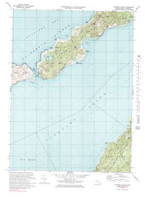
Nauson Island Topo Map Massachusetts
To zoom in, hover over the map of Nauson Island
USGS Topo Quad 41070d6 - 1:25,000 scale
| Topo Map Name: | Nauson Island |
| USGS Topo Quad ID: | 41070d6 |
| Print Size: | ca. 21 1/4" wide x 27" high |
| Southeast Coordinates: | 41.375° N latitude / 70.625° W longitude |
| Map Center Coordinates: | 41.4375° N latitude / 70.6875° W longitude |
| U.S. State: | MA |
| Filename: | l41070d6.jpg |
| Download Map JPG Image: | Nauson Island topo map 1:25,000 scale |
| Map Type: | Topographic |
| Topo Series: | 7.5´ |
| Map Scale: | 1:25,000 |
| Source of Map Images: | United States Geological Survey (USGS) |
| Alternate Map Versions: |
1:24,000 Topo Quads surrounding Nauson Island
New Bedford North |
Marion |
Onset |
Pocasset |
Sandwich |
New Bedford South |
Sconticut Neck |
Woods Hole |
Falmouth |
Cotuit |
Cuttyhunk |
Nauson Island |
Vineyard Haven |
||
Squibnocket |
Tisbury Great Pond |
Edgartown |
||
> Back to 41070a1 at 1:100,000 scale
> Back to 41070a1 at 1:250,000 scale
> Back to U.S. Topo Maps home
Nauson Island topo map: Gazetteer
Nauson Island: Bars
Lucas Shoal elevation 0m 0′Middle Ground elevation 0m 0′
Nauson Island: Bays
Drew Cove elevation 5m 16′Lamberts Cove elevation 0m 0′
Nauson Island: Beaches
Lake Tashmoo Town Beach elevation 0m 0′Lamberts Cove Beach elevation 0m 0′
North Shore Beach elevation 2m 6′
Nauson Island: Capes
Cape Higgon elevation 44m 144′Cape Higgon elevation 0m 0′
Hullman Point elevation 0m 0′
Jobs Neck elevation 0m 0′
Kuffies Point elevation 0m 0′
Norton Point elevation 0m 0′
Paul Point elevation 0m 0′
Nauson Island: Cliffs
Cedar Tree Neck elevation 6m 19′Makonikey Head elevation 30m 98′
South Bluff elevation 4m 13′
Nauson Island: Dams
Crocker Pond Dam elevation 23m 75′Fisher Pond Dam elevation 20m 65′
Nauson Island: Islands
Norton Rock elevation 0m 0′Nauson Island: Lakes
Crane Pond elevation 11m 36′Doggetts Pond elevation 3m 9′
Duarte Ponds elevation 30m 98′
Duck Pond elevation 2m 6′
Flat Bottom Pond elevation 36m 118′
Grey Pond elevation 0m 0′
Harlock Pond elevation 30m 98′
James Pond elevation 0m 0′
Lily Pond elevation 0m 0′
Molasses Pond elevation 0m 0′
Old House Pond elevation 25m 82′
Rhoda Pond elevation -5m -17′
Seths Pond elevation 13m 42′
Nauson Island: Parks
Cedar Tree Neck Sanctuary elevation 2m 6′Nauson Island: Plains
Great Plains elevation 25m 82′Nauson Island: Populated Places
Christian Town elevation 63m 206′Lamberts Cove elevation 18m 59′
Longview elevation 39m 127′
Makonikey elevation 8m 26′
Naushon Station elevation 41m 134′
North Tisbury elevation 20m 65′
West Tisbury elevation 13m 42′
Nauson Island: Post Offices
West Tisbury Post Office elevation 9m 29′Nauson Island: Reservoirs
Crocker Pond elevation 17m 55′Davis Pond elevation 9m 29′
Fisher Pond elevation 20m 65′
Looks Pond elevation 7m 22′
Old Millpond elevation 5m 16′
Priester Pond elevation 16m 52′
Nauson Island: Springs
Tashmoo Spring elevation 13m 42′Nauson Island: Streams
Blackwater Brook elevation 0m 0′Mill Brook elevation 3m 9′
Mud Creek elevation 40m 131′
Paint Mill Brook elevation 0m 0′
Point Mill Brook elevation 0m 0′
Witch Brook elevation 16m 52′
Nauson Island: Summits
Goat Rocks elevation 44m 144′Mount Cary elevation 30m 98′
Mount Surat elevation 48m 157′
Pilot Hill elevation 41m 134′
Whiting Hill elevation 68m 223′
Nauson Island: Swamps
Great Swamp elevation 4m 13′James Pond Marshes elevation 0m 0′
Nauson Island: Valleys
Deep Bottom elevation 16m 52′Eagle Hollow elevation 24m 78′
Witches Glen elevation 16m 52′
Nauson Island digital topo map on disk
Buy this Nauson Island topo map showing relief, roads, GPS coordinates and other geographical features, as a high-resolution digital map file on DVD:
Maine, New Hampshire, Rhode Island & Eastern Massachusetts
Buy digital topo maps: Maine, New Hampshire, Rhode Island & Eastern Massachusetts


