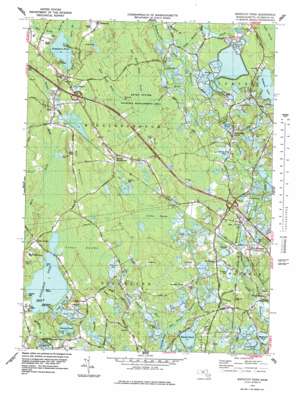
Snipatuit Pond Topo Map Massachusetts
To zoom in, hover over the map of Snipatuit Pond
USGS Topo Quad 41070g7 - 1:25,000 scale
| Topo Map Name: | Snipatuit Pond |
| USGS Topo Quad ID: | 41070g7 |
| Print Size: | ca. 21 1/4" wide x 27" high |
| Southeast Coordinates: | 41.75° N latitude / 70.75° W longitude |
| Map Center Coordinates: | 41.8125° N latitude / 70.8125° W longitude |
| U.S. State: | MA |
| Filename: | l41070g7.jpg |
| Download Map JPG Image: | Snipatuit Pond topo map 1:25,000 scale |
| Map Type: | Topographic |
| Topo Series: | 7.5´ |
| Map Scale: | 1:25,000 |
| Source of Map Images: | United States Geological Survey (USGS) |
| Alternate Map Versions: |
Snipatuit Pond MA 1977, updated 1979 Download PDF Buy paper map Snipatuit Pond MA 1977, updated 1981 Download PDF Buy paper map |
1:24,000 Topo Quads surrounding Snipatuit Pond
> Back to 41070e1 at 1:100,000 scale
> Back to 41070a1 at 1:250,000 scale
> Back to U.S. Topo Maps home
Snipatuit Pond topo map: Gazetteer
Snipatuit Pond: Airports
Bulljump Airport elevation 20m 65′Island Air Service Seaplane Base elevation 16m 52′
Sampson Pond Heliport elevation 33m 108′
Wayne West Heliport elevation 24m 78′
Snipatuit Pond: Capes
Deep Point elevation 16m 52′Snipatuit Pond: Dams
Atwood Lower Reservoir Dam elevation 23m 75′Atwood Upper Reservoir Dam elevation 26m 85′
Blackmore Pond East Dam elevation 6m 19′
Blackmore Pond West Dam elevation 6m 19′
Continental Can of America Dam A elevation 8m 26′
Cross Street Number 2 Dam elevation 7m 22′
Double Brook Dam elevation 23m 75′
Edgewood Trust Number 3 Dam elevation 17m 55′
France Street Dam elevation 23m 75′
Gibbs Number 2 Dam elevation 23m 75′
Gibbs Number 3 Dam elevation 23m 75′
Holmes Street Dam elevation 25m 82′
Makepeace Number 1 Dam elevation 17m 55′
Makepeace Number 2 Dam elevation 20m 65′
Slocum - Gibbs Dam Number 2 elevation 22m 72′
Slocum - Gibbs Number 1 Dam elevation 20m 65′
Tremont Mill Pond Dam elevation 14m 45′
Snipatuit Pond: Forests
Cedar Swamp Town Forest elevation 27m 88′Snipatuit Pond: Islands
Gull Island elevation 16m 52′High Bush Island elevation 16m 52′
Low Bush Island elevation 15m 49′
Snipatuit Pond: Lakes
Bates Pond elevation 24m 78′Bensons Pond (historical) elevation 23m 75′
Leonards Pond elevation 8m 26′
Long Pond elevation 16m 52′
Marys Pond elevation 9m 29′
Mill Pond elevation 19m 62′
Snipatuit Pond elevation 16m 52′
Snows Pond elevation 17m 55′
Tispaquin Pond elevation 26m 85′
Snipatuit Pond: Parks
Camp Avoda elevation 28m 91′Camp Snipatuit elevation 20m 65′
Camp Yomechas elevation 26m 85′
Rochester Wildlife Management Area elevation 12m 39′
Rocky Gutter Wildlife Area elevation 27m 88′
Rocky Gutter Wildlife Management Area elevation 26m 85′
Savery Historic District elevation 33m 108′
Snipatuit Pond: Populated Places
Bisbee Corner elevation 31m 101′Camp Avoda elevation 28m 91′
Camp Snipatuit elevation 25m 82′
Camp Yomechas elevation 26m 85′
Cowen Corner elevation 26m 85′
Douglas Corner elevation 20m 65′
Five Corners elevation 24m 78′
Gibbs Grove elevation 31m 101′
Howlands elevation 27m 88′
Huckleberry Corner elevation 28m 91′
Rock elevation 19m 62′
South Middleboro elevation 35m 114′
Tremont elevation 23m 75′
West Wareham elevation 18m 59′
Snipatuit Pond: Post Offices
Rock Post Office (historical) elevation 18m 59′South Middleborough Post Office (historical) elevation 33m 108′
West Wareham Post Office elevation 10m 32′
West Wareham Post Office (historical) elevation 19m 62′
Snipatuit Pond: Reservoirs
Atwood Lower Reservoir elevation 23m 75′Atwood Upper Reservoir elevation 26m 85′
Big Bearhole Pond elevation 31m 101′
Blackmore Pond elevation 6m 19′
Bog Pond elevation 17m 55′
Bog Pond elevation 8m 26′
Cross Street Bog Reservoir elevation 7m 22′
Double Brook Reservoir elevation 23m 75′
Rocky Meadow Brook Reservoir elevation 23m 75′
Sherman Bog Reservoir elevation 17m 55′
South Meadow Brook Reservoir elevation 25m 82′
Tremont Mill Pond elevation 14m 45′
Weweantic River Reservoir elevation 20m 65′
Snipatuit Pond: Streams
Beaverdam Brook elevation 21m 68′Cedar Swamp Brook elevation 16m 52′
Crane Brook elevation 17m 55′
Double Brook elevation 21m 68′
East Branch Sippican River elevation 7m 22′
East Rocky Gutter Brook elevation 28m 91′
Indian Brook elevation 19m 62′
Millers Neck Brook elevation 15m 49′
Rocky Meadow Brook elevation 23m 75′
Shorts Brook elevation 26m 85′
Snipatuit Brook elevation 15m 49′
South Meadow Brook elevation 23m 75′
West Branch Sippican River elevation 7m 22′
West Rocky Gutter Brook elevation 28m 91′
Woods Brook elevation 26m 85′
Snipatuit Pond: Summits
Fearing Hill elevation 18m 59′The Highlands elevation 40m 131′
Vaughn Hill elevation 28m 91′
Snipatuit Pond: Swamps
Atwood Bogs elevation 26m 85′Benson Pond Bogs elevation 23m 75′
Cedar Swamp elevation 26m 85′
Forbes Swamp elevation 23m 75′
Long Pond Bog elevation 13m 42′
Mad Mares Neck elevation 31m 101′
South Purchase Swamp elevation 27m 88′
Stewart Bog elevation 17m 55′
Stewart Bog elevation 17m 55′
Snipatuit Pond digital topo map on disk
Buy this Snipatuit Pond topo map showing relief, roads, GPS coordinates and other geographical features, as a high-resolution digital map file on DVD:
Maine, New Hampshire, Rhode Island & Eastern Massachusetts
Buy digital topo maps: Maine, New Hampshire, Rhode Island & Eastern Massachusetts


