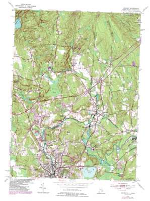
Ashaway Topo Map Connecticut
To zoom in, hover over the map of Ashaway
USGS Topo Quad 41071d7 - 1:24,000 scale
| Topo Map Name: | Ashaway |
| USGS Topo Quad ID: | 41071d7 |
| Print Size: | ca. 21 1/4" wide x 27" high |
| Southeast Coordinates: | 41.375° N latitude / 71.75° W longitude |
| Map Center Coordinates: | 41.4375° N latitude / 71.8125° W longitude |
| U.S. States: | CT, RI |
| Filename: | o41071d7.jpg |
| Download Map JPG Image: | Ashaway topo map 1:24,000 scale |
| Map Type: | Topographic |
| Topo Series: | 7.5´ |
| Map Scale: | 1:24,000 |
| Source of Map Images: | United States Geological Survey (USGS) |
| Alternate Map Versions: |
Ashaway RI 1953, updated 1957 Download PDF Buy paper map Ashaway RI 1953, updated 1964 Download PDF Buy paper map Ashaway RI 1953, updated 1972 Download PDF Buy paper map Ashaway RI 1953, updated 1976 Download PDF Buy paper map Ashaway RI 1984, updated 1985 Download PDF Buy paper map Ashaway RI 1984, updated 1985 Download PDF Buy paper map Ashaway RI 2001, updated 2003 Download PDF Buy paper map Ashaway RI 2012 Download PDF Buy paper map Ashaway RI 2015 Download PDF Buy paper map |
1:24,000 Topo Quads surrounding Ashaway
> Back to 41071a1 at 1:100,000 scale
> Back to 41070a1 at 1:250,000 scale
> Back to U.S. Topo Maps home
Ashaway topo map: Gazetteer
Ashaway: Bridges
Boom Bridge elevation 7m 22′Meeting-House Bridge elevation 8m 26′
Pawcatuck Bridge elevation 3m 9′
Ashaway: Crossings
Interchange 1 elevation 42m 137′Interchange 3 elevation 32m 104′
Interchange 4 elevation 38m 124′
Interchange 5 elevation 20m 65′
Interchange 92 elevation 25m 82′
Interchange 93 elevation 24m 78′
Ashaway: Dams
Potter Hill Dam elevation 10m 32′Spaulding Pond Dam elevation 28m 91′
White Rock Dam elevation 15m 49′
Wyassup Lake Dam elevation 91m 298′
Ashaway: Islands
Kedinker Island elevation 9m 29′Ashaway: Lakes
Chapman Pond elevation 11m 36′Lewis Pond elevation 13m 42′
Shingle Mill Pond elevation 59m 193′
Spalding Pond elevation 28m 91′
Wyassup Lake elevation 91m 298′
Ashaway: Parks
Hopkinton City Historic District elevation 52m 170′Newton Swamp Management Area elevation 12m 39′
Westerly Downtown Historic District elevation 11m 36′
Wilcox Arboretum elevation 6m 19′
Wilcox Park Historic District elevation 6m 19′
Ashaway: Populated Places
Ashaway elevation 19m 62′Bethel elevation 25m 82′
Clarks Falls elevation 28m 91′
Hopkinton elevation 51m 167′
Laurel Glen elevation 44m 144′
McGowan Corners elevation 27m 88′
Pawcatuck elevation 3m 9′
Potter Hill elevation 14m 45′
South Hopkinton elevation 15m 49′
Stillmanville elevation 32m 104′
Westerly elevation 11m 36′
White Rock elevation 8m 26′
Ashaway: Post Offices
Westerly Post Office elevation 3m 9′Ashaway: Reservoirs
Burch Pond elevation 24m 78′Spaulding Pond elevation 28m 91′
Ashaway: Streams
Ashaway River elevation 8m 26′Ashaway River elevation 7m 22′
Glade Brook elevation 18m 59′
Green Fall River elevation 17m 55′
Green Fall River elevation 17m 55′
Hetchel Swamp Brook elevation 53m 173′
McGowan Brook elevation 8m 26′
Mile Brook elevation 8m 26′
Parmenter Brook elevation 17m 55′
Pendleton Hill Brook elevation 28m 91′
Red Brook (historical) elevation 11m 36′
Shunock River elevation 7m 22′
Tomaquag Brook elevation 9m 29′
Wine Brook elevation 40m 131′
Wyassup Brook elevation 20m 65′
Ashaway: Summits
Brightman Hill elevation 62m 203′Bumpin Hill elevation 48m 157′
Champlin Hill elevation 125m 410′
Chapman Hill elevation 158m 518′
Chase Hill elevation 57m 187′
Cooky Hill elevation 6m 19′
Diamond Hill elevation 65m 213′
Hinkley Hill elevation 65m 213′
Maxon Hill elevation 70m 229′
Mount Moriah elevation 77m 252′
Ashaway: Swamps
Bell Cedar Swamp elevation 28m 91′Hetchel Swamp elevation 97m 318′
Ashaway digital topo map on disk
Buy this Ashaway topo map showing relief, roads, GPS coordinates and other geographical features, as a high-resolution digital map file on DVD:
Maine, New Hampshire, Rhode Island & Eastern Massachusetts
Buy digital topo maps: Maine, New Hampshire, Rhode Island & Eastern Massachusetts


