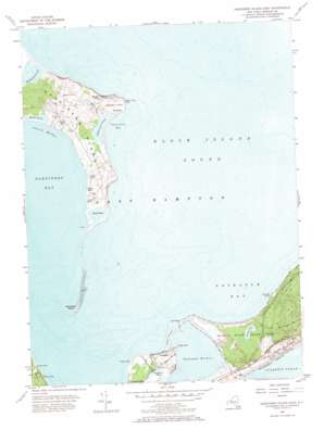
Gardiners Island East Topo Map New York
To zoom in, hover over the map of Gardiners Island East
USGS Topo Quad 41072a1 - 1:24,000 scale
| Topo Map Name: | Gardiners Island East |
| USGS Topo Quad ID: | 41072a1 |
| Print Size: | ca. 21 1/4" wide x 27" high |
| Southeast Coordinates: | 41° N latitude / 72° W longitude |
| Map Center Coordinates: | 41.0625° N latitude / 72.0625° W longitude |
| U.S. State: | NY |
| Filename: | o41072a1.jpg |
| Download Map JPG Image: | Gardiners Island East topo map 1:24,000 scale |
| Map Type: | Topographic |
| Topo Series: | 7.5´ |
| Map Scale: | 1:24,000 |
| Source of Map Images: | United States Geological Survey (USGS) |
| Alternate Map Versions: |
Gardiners Island East NY 1943, updated 1947 Download PDF Buy paper map Gardiners Island East NY 1956, updated 1957 Download PDF Buy paper map Gardiners Island East NY 1956, updated 1966 Download PDF Buy paper map Gardiners Island East NY 2010 Download PDF Buy paper map Gardiners Island East NY 2013 Download PDF Buy paper map Gardiners Island East NY 2016 Download PDF Buy paper map |
1:24,000 Topo Quads surrounding Gardiners Island East
Old Lyme |
Niantic |
New London |
Mystic |
Watch Hill |
Orient |
Plum Island |
|||
Greenport |
Gardiners Island West |
Gardiners Island East |
Montauk Point |
|
Sag Harbor |
East Hampton |
Napeague Beach |
||
> Back to 41072a1 at 1:100,000 scale
> Back to 41072a1 at 1:250,000 scale
> Back to U.S. Topo Maps home
Gardiners Island East topo map: Gazetteer
Gardiners Island East: Bars
Cartwright Shoals elevation 0m 0′Gardiners Island East: Bays
Cherry Harbor elevation 0m 0′Napeague Bay elevation 0m 0′
Napeague Harbor elevation 0m 0′
Tobaccolot Bay elevation 0m 0′
Gardiners Island East: Capes
Cherry Point elevation 2m 6′Eastern Plain Point elevation 3m 9′
Goff Point elevation 1m 3′
Lazy Point elevation 1m 3′
Gardiners Island East: Flats
Eastern Plain elevation 7m 22′Gardiners Island East: Guts
Bostwick Creek elevation 0m 0′Gardiners Island East: Islands
Cartwright Island elevation 1m 3′Gardiners Island elevation 28m 91′
Hicks Island elevation 1m 3′
Gardiners Island East: Lakes
Airport Pond elevation 0m 0′Fresh Pond elevation 2m 6′
Gales Pond elevation 0m 0′
Gaylor Hole elevation 2m 6′
Great Pond elevation 0m 0′
Home Pond elevation 0m 0′
Lily Pond elevation 1m 3′
Little Pond elevation 0m 0′
Napeague Pond elevation 1m 3′
Tobaccolot Pond elevation 1m 3′
Gardiners Island East: Parks
Hither Hills State Park elevation 7m 22′Gardiners Island East: Populated Places
Napeague elevation 2m 6′Gardiners Island East: Streams
Willow Brook elevation 1m 3′Gardiners Island East: Summits
Whale Hill elevation 35m 114′Gardiners Island East digital topo map on disk
Buy this Gardiners Island East topo map showing relief, roads, GPS coordinates and other geographical features, as a high-resolution digital map file on DVD:
New York, Vermont, Connecticut & Western Massachusetts
Buy digital topo maps: New York, Vermont, Connecticut & Western Massachusetts


