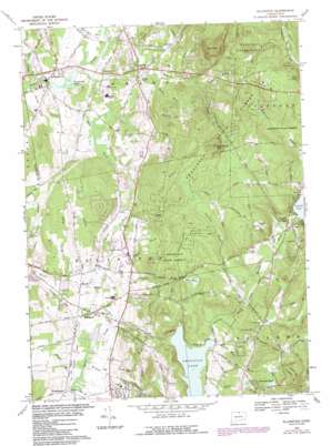
Ellington Topo Map Connecticut
To zoom in, hover over the map of Ellington
USGS Topo Quad 41072h4 - 1:24,000 scale
| Topo Map Name: | Ellington |
| USGS Topo Quad ID: | 41072h4 |
| Print Size: | ca. 21 1/4" wide x 27" high |
| Southeast Coordinates: | 41.875° N latitude / 72.375° W longitude |
| Map Center Coordinates: | 41.9375° N latitude / 72.4375° W longitude |
| U.S. State: | CT |
| Filename: | o41072h4.jpg |
| Download Map JPG Image: | Ellington topo map 1:24,000 scale |
| Map Type: | Topographic |
| Topo Series: | 7.5´ |
| Map Scale: | 1:24,000 |
| Source of Map Images: | United States Geological Survey (USGS) |
| Alternate Map Versions: |
Ellington CT 1953, updated 1958 Download PDF Buy paper map Ellington CT 1953, updated 1965 Download PDF Buy paper map Ellington CT 1967, updated 1969 Download PDF Buy paper map Ellington CT 1967, updated 1973 Download PDF Buy paper map Ellington CT 1967, updated 1984 Download PDF Buy paper map Ellington CT 2012 Download PDF Buy paper map Ellington CT 2015 Download PDF Buy paper map |
1:24,000 Topo Quads surrounding Ellington
> Back to 41072e1 at 1:100,000 scale
> Back to 41072a1 at 1:250,000 scale
> Back to U.S. Topo Maps home
Ellington topo map: Gazetteer
Ellington: Airports
Ellington Airport elevation 79m 259′Wysocki Field elevation 118m 387′
Ellington: Dams
Lake Bonair Dam elevation 191m 626′Pomercy Dam elevation 198m 649′
Pomeroy Dam elevation 207m 679′
Somersville Pond Dam elevation 58m 190′
Ellington: Forests
Shenipsit State Forest elevation 270m 885′Ellington: Lakes
Bradleys Pond elevation 60m 196′Lafayette Pond elevation 54m 177′
Lake Bonair elevation 184m 603′
Shady Lake elevation 79m 259′
Somersville Pond elevation 58m 190′
Ellington: Populated Places
Crystal Lake elevation 208m 682′Ellington elevation 73m 239′
Somers elevation 79m 259′
Somersville elevation 56m 183′
Windermere elevation 68m 223′
Ellington: Reservoirs
Charters Pond elevation 185m 606′Lake Bonair elevation 191m 626′
Poehnerts Pond elevation 264m 866′
Pomeroy Reservoir elevation 198m 649′
Ellington: Streams
Abbey Brook elevation 58m 190′Bahlers Brook elevation 62m 203′
Belding Brook elevation 67m 219′
Browns Brook elevation 172m 564′
Cemetery Brook elevation 156m 511′
Charters Brook elevation 155m 508′
Davis Brook elevation 76m 249′
Grants Brook elevation 169m 554′
Gulf Stream elevation 58m 190′
Hall Hill Brook elevation 58m 190′
Hydes Brook elevation 67m 219′
Kibbes Brook elevation 61m 200′
Kimballs Brook elevation 63m 206′
Lievre Brook elevation 125m 410′
Marsh Brook elevation 67m 219′
Martins Brook elevation 167m 547′
Mitchells Brook elevation 180m 590′
Muddy Brook elevation 61m 200′
Pease Brook elevation 62m 203′
Pinney Brook elevation 66m 216′
Shady Brook elevation 82m 269′
Spring Brook elevation 48m 157′
Sucker Brook elevation 155m 508′
Turkey Brook elevation 76m 249′
West Brook elevation 158m 518′
Woods Stream elevation 48m 157′
Wrights Brook elevation 54m 177′
Ellington: Summits
Bald Mountain elevation 322m 1056′Chestnut Mountain elevation 275m 902′
Newell Hill elevation 264m 866′
Paulk Hill elevation 294m 964′
Soapstone Mountain elevation 315m 1033′
Ellington digital topo map on disk
Buy this Ellington topo map showing relief, roads, GPS coordinates and other geographical features, as a high-resolution digital map file on DVD:
New York, Vermont, Connecticut & Western Massachusetts
Buy digital topo maps: New York, Vermont, Connecticut & Western Massachusetts


