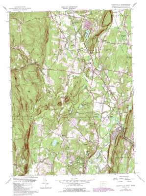
Tariffville Topo Map Connecticut
To zoom in, hover over the map of Tariffville
USGS Topo Quad 41072h7 - 1:24,000 scale
| Topo Map Name: | Tariffville |
| USGS Topo Quad ID: | 41072h7 |
| Print Size: | ca. 21 1/4" wide x 27" high |
| Southeast Coordinates: | 41.875° N latitude / 72.75° W longitude |
| Map Center Coordinates: | 41.9375° N latitude / 72.8125° W longitude |
| U.S. States: | CT, MA |
| Filename: | o41072h7.jpg |
| Download Map JPG Image: | Tariffville topo map 1:24,000 scale |
| Map Type: | Topographic |
| Topo Series: | 7.5´ |
| Map Scale: | 1:24,000 |
| Source of Map Images: | United States Geological Survey (USGS) |
| Alternate Map Versions: |
Tariffville CT 1956, updated 1958 Download PDF Buy paper map Tariffville CT 1956, updated 1966 Download PDF Buy paper map Tariffville CT 1956, updated 1972 Download PDF Buy paper map Tariffville CT 1956, updated 1979 Download PDF Buy paper map Tariffville CT 1956, updated 1984 Download PDF Buy paper map Tariffville CT 1956, updated 1988 Download PDF Buy paper map Tariffville CT 2012 Download PDF Buy paper map Tariffville CT 2015 Download PDF Buy paper map |
1:24,000 Topo Quads surrounding Tariffville
> Back to 41072e1 at 1:100,000 scale
> Back to 41072a1 at 1:250,000 scale
> Back to U.S. Topo Maps home
Tariffville topo map: Gazetteer
Tariffville: Airports
Simsbury Airport elevation 62m 203′Tariffville: Bays
Pickerel Cove elevation 59m 193′Tariffville: Dams
Great Pond Dam elevation 90m 295′Lake Basile Dam elevation 51m 167′
Manitook Lake Dam elevation 59m 193′
Simsbury Reservoir Dam elevation 91m 298′
Tariffville: Flats
Terrys Plain elevation 48m 157′Tariffville: Forests
Great Pond State Forest elevation 90m 295′Tariffville: Gaps
The Notch elevation 88m 288′Tariffville: Islands
Holcomb Island elevation 52m 170′Tariffville: Lakes
Great Pond elevation 90m 295′Kettle Pond elevation 100m 328′
Manitook Lake elevation 59m 193′
Marsh Pond elevation 74m 242′
Spring Pond elevation 65m 213′
Three Corner Pond elevation 77m 252′
Trout Pond elevation 56m 183′
Tariffville: Parks
Curtis Park elevation 49m 160′Granbrook Park elevation 55m 180′
Granby Center Historic District elevation 70m 229′
Marion K Wilcox Park elevation 65m 213′
Mc Lean Game Refuge elevation 114m 374′
Newgate State Wildlife Area elevation 93m 305′
Schultz Park elevation 79m 259′
Tariffville Park elevation 48m 157′
War Memorial Park elevation 84m 275′
Tariffville: Populated Places
Carroll Corners elevation 56m 183′Chatsworth Village elevation 69m 226′
Firetown elevation 108m 354′
Five Points elevation 90m 295′
Floydville elevation 65m 213′
Goodrichville elevation 80m 262′
Granbrook Park elevation 65m 213′
Granby elevation 69m 226′
Hoskins elevation 51m 167′
Hungary elevation 83m 272′
Meadowgate elevation 63m 206′
Mechanicsville elevation 69m 226′
North Granby elevation 86m 282′
Pegville elevation 81m 265′
Salmon Brook elevation 77m 252′
Simsbury elevation 63m 206′
Tariffville elevation 62m 203′
Tariffville Center elevation 62m 203′
The Gables elevation 54m 177′
West Granby elevation 122m 400′
Windmill Springs elevation 70m 229′
Tariffville: Post Offices
Granby Post Office (historical) elevation 70m 229′North Granby Post Office elevation 92m 301′
West Granby Post Office elevation 113m 370′
Tariffville: Ranges
Barndoor Hills elevation 175m 574′The Knolls elevation 154m 505′
West Mountains elevation 209m 685′
Tariffville: Reservoirs
Griffin Pond elevation 75m 246′Lake Basile elevation 51m 167′
Simsbury Reservoir elevation 139m 456′
Tuller Reservoir elevation 91m 298′
Tariffville: Streams
Beach Brook elevation 94m 308′Bissell Brook elevation 53m 173′
Bissell Brook elevation 62m 203′
Bradley Brook elevation 74m 242′
Bradley Brook elevation 73m 239′
Creamery Brook elevation 72m 236′
Dismal Brook elevation 83m 272′
Dismal Brook elevation 83m 272′
East Branch Salmon Brook elevation 55m 180′
East Branch Salmon Brook elevation 57m 187′
Griffin Brook elevation 35m 114′
Higley Brook elevation 155m 508′
Holcomb Brook elevation 63m 206′
Hungary Brook elevation 70m 229′
Kendall Brook elevation 99m 324′
Kendell Brook elevation 59m 193′
Moosehorn Brook elevation 206m 675′
Mountain Brook elevation 84m 275′
Muddy Brook elevation 48m 157′
Munnisunk Brook elevation 57m 187′
Owens Brook elevation 49m 160′
Salmon Brook elevation 54m 177′
Saxton Brook elevation 55m 180′
West Branch Salmon Brook elevation 55m 180′
Tariffville: Summits
Broad Hill elevation 238m 780′Bushy Hill elevation 148m 485′
Duncaster Hill elevation 136m 446′
Laurel Hill elevation 116m 380′
Manitook Mountain elevation 119m 390′
Pine Cone elevation 323m 1059′
Stony Hill elevation 103m 337′
The Hedgehog elevation 185m 606′
Weed Hill elevation 241m 790′
West Ledge elevation 305m 1000′
Williams Hill elevation 91m 298′
Tariffville: Swamps
Beaverdam Marsh elevation 89m 291′Great Marsh elevation 84m 275′
Tariffville: Valleys
Huggins Gorge elevation 148m 485′Tariffville digital topo map on disk
Buy this Tariffville topo map showing relief, roads, GPS coordinates and other geographical features, as a high-resolution digital map file on DVD:
New York, Vermont, Connecticut & Western Massachusetts
Buy digital topo maps: New York, Vermont, Connecticut & Western Massachusetts


