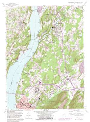
Wappingers Falls Topo Map New York
To zoom in, hover over the map of Wappingers Falls
USGS Topo Quad 41073e8 - 1:24,000 scale
| Topo Map Name: | Wappingers Falls |
| USGS Topo Quad ID: | 41073e8 |
| Print Size: | ca. 21 1/4" wide x 27" high |
| Southeast Coordinates: | 41.5° N latitude / 73.875° W longitude |
| Map Center Coordinates: | 41.5625° N latitude / 73.9375° W longitude |
| U.S. State: | NY |
| Filename: | o41073e8.jpg |
| Download Map JPG Image: | Wappingers Falls topo map 1:24,000 scale |
| Map Type: | Topographic |
| Topo Series: | 7.5´ |
| Map Scale: | 1:24,000 |
| Source of Map Images: | United States Geological Survey (USGS) |
| Alternate Map Versions: |
Wappinger Falls NY 1947 Download PDF Buy paper map Wappinger Falls NY 1947 Download PDF Buy paper map Wappingers Falls NY 1956, updated 1965 Download PDF Buy paper map Wappingers Falls NY 1956, updated 1973 Download PDF Buy paper map Wappingers Falls NY 1956, updated 1982 Download PDF Buy paper map Wappingers Falls NY 2010 Download PDF Buy paper map Wappingers Falls NY 2013 Download PDF Buy paper map Wappingers Falls NY 2016 Download PDF Buy paper map |
1:24,000 Topo Quads surrounding Wappingers Falls
> Back to 41073e1 at 1:100,000 scale
> Back to 41072a1 at 1:250,000 scale
> Back to U.S. Topo Maps home
Wappingers Falls topo map: Gazetteer
Wappingers Falls: Bars
Diamond Reef elevation 0m 0′Wappingers Falls: Bridges
Newburgh-Beacon Bridge elevation 0m 0′Wappingers Falls: Capes
Danskammer Point elevation 3m 9′Low Point elevation 2m 6′
Pegs Point elevation 18m 59′
Wappingers Falls: Channels
Lange Rack elevation 0m 0′Wappingers Falls: Crossings
Beacon-Newburgh Ferry elevation 0m 0′Wappingers Falls: Lakes
Cobalt Lake elevation 8m 26′Greens Pond elevation 38m 124′
Lake Oniad elevation 68m 223′
Willow Lake elevation 120m 393′
Wappingers Falls: Mines
Clinton Point Quarry elevation 6m 19′Wappingers Falls: Parks
Beacon Memorial Park Athletic Field elevation 45m 147′Dutchess Stadium elevation 49m 160′
Fountain Square elevation 38m 124′
Geering Park elevation 66m 216′
Hammond Plaza elevation 7m 22′
Lower Main Street Historic District elevation 46m 150′
Main Street Historic District elevation 5m 16′
Mesier Park elevation 46m 150′
Riverfront Park elevation 2m 6′
Stone Street Historic District elevation 12m 39′
Wappingers Falls: Populated Places
Beacon elevation 42m 137′Beacon Hills elevation 76m 249′
Birchwood Park elevation 81m 265′
Brockway elevation 22m 72′
Castle Point elevation 54m 177′
Cedar Cliff elevation 2m 6′
Chelsea elevation 12m 39′
Cooper Road Mobile Home Park elevation 84m 275′
Fishkill elevation 67m 219′
Fishkill Landing (historical) elevation 12m 39′
Glenham elevation 78m 255′
Groveville elevation 75m 246′
Howland elevation 70m 229′
Hughsonville elevation 51m 167′
Marlboro elevation 55m 180′
New Hamburg elevation 21m 68′
Roseton elevation 2m 6′
Stoneco elevation 5m 16′
Wappingers Falls elevation 47m 154′
Wappingers Falls: Reservoirs
Wappinger Lake elevation 24m 78′Wappingers Falls: Ridges
Purdy Ridge elevation 82m 269′Van Wyck Ridge elevation 115m 377′
Verplanck Ridge elevation 98m 321′
Wappingers Falls: Streams
Casper Creek elevation 0m 0′Clove Creek elevation 59m 193′
Dry Brook elevation 51m 167′
Lattintown Creek elevation 0m 0′
Wappinger Creek elevation 0m 0′
Wappingers Falls: Summits
Bald Hill elevation 456m 1496′Osborne Hill elevation 96m 314′
Soap Hill elevation 98m 321′
Watch Hill elevation 122m 400′
Wappingers Falls: Swamps
Cranberry Bog elevation 50m 164′Wappingers Falls digital topo map on disk
Buy this Wappingers Falls topo map showing relief, roads, GPS coordinates and other geographical features, as a high-resolution digital map file on DVD:
New York, Vermont, Connecticut & Western Massachusetts
Buy digital topo maps: New York, Vermont, Connecticut & Western Massachusetts


