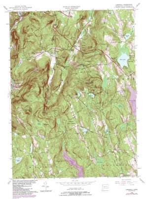
Cornwall Topo Map Connecticut
To zoom in, hover over the map of Cornwall
USGS Topo Quad 41073g3 - 1:24,000 scale
| Topo Map Name: | Cornwall |
| USGS Topo Quad ID: | 41073g3 |
| Print Size: | ca. 21 1/4" wide x 27" high |
| Southeast Coordinates: | 41.75° N latitude / 73.25° W longitude |
| Map Center Coordinates: | 41.8125° N latitude / 73.3125° W longitude |
| U.S. State: | CT |
| Filename: | o41073g3.jpg |
| Download Map JPG Image: | Cornwall topo map 1:24,000 scale |
| Map Type: | Topographic |
| Topo Series: | 7.5´ |
| Map Scale: | 1:24,000 |
| Source of Map Images: | United States Geological Survey (USGS) |
| Alternate Map Versions: |
Cornwall CT 1956, updated 1958 Download PDF Buy paper map Cornwall CT 1956, updated 1965 Download PDF Buy paper map Cornwall CT 1956, updated 1971 Download PDF Buy paper map Cornwall CT 1956, updated 1984 Download PDF Buy paper map Cornwall CT 2012 Download PDF Buy paper map Cornwall CT 2015 Download PDF Buy paper map |
1:24,000 Topo Quads surrounding Cornwall
> Back to 41073e1 at 1:100,000 scale
> Back to 41072a1 at 1:250,000 scale
> Back to U.S. Topo Maps home
Cornwall topo map: Gazetteer
Cornwall: Airports
Ripley Field elevation 396m 1299′Wings Ago Airstrip elevation 391m 1282′
Cornwall: Areas
The Crooed Esses elevation 323m 1059′Cornwall: Cliffs
The Ballyhack elevation 247m 810′Cornwall: Dams
Gritman Pond Dam elevation 399m 1309′Nash Pond Dam elevation 244m 800′
Tyler Lake Dam elevation 394m 1292′
Woodridge Lake Dam elevation 346m 1135′
Cornwall: Forests
Mohawk State Forest elevation 422m 1384′Cornwall: Lakes
Clark Pond elevation 382m 1253′Hart Pond elevation 371m 1217′
Hawkins Pond elevation 300m 984′
Milton Pond elevation 316m 1036′
Mohawk Pond elevation 360m 1181′
Cornwall: Parks
Milton Center Historic District elevation 327m 1072′Mohawk State Park elevation 359m 1177′
Cornwall: Populated Places
Corner of the Pines elevation 218m 715′Cornwall elevation 219m 718′
Cornwall Bridge elevation 147m 482′
East Cornwall elevation 388m 1272′
Milton elevation 321m 1053′
North Cornwall elevation 362m 1187′
Tyler Lake Heights elevation 415m 1361′
West Cornwall elevation 161m 528′
West Goshen elevation 396m 1299′
Cornwall: Post Offices
Cornwall Bridge Post Office elevation 147m 482′Cornwall Post Office elevation 212m 695′
Cornwall: Reservoirs
Cunningham Pond elevation 447m 1466′Gritman Pond elevation 386m 1266′
Nash Pond elevation 244m 800′
Stony Batter Pond elevation 389m 1276′
Tyler Lake elevation 387m 1269′
West Side Pond elevation 390m 1279′
Woodbridge Lake elevation 346m 1135′
Cornwall: Ridges
The Hogback elevation 335m 1099′Cornwall: Streams
Baldwin Brook elevation 198m 649′Birdseye Brook elevation 199m 652′
Bloody Brook elevation 197m 646′
Carse Brook elevation 146m 479′
Furnace Brook elevation 131m 429′
Heffers Brook elevation 246m 807′
Ivy Brook elevation 147m 482′
Marshepaug River elevation 298m 977′
Mill Brook elevation 153m 501′
Pine Swamp Brook elevation 148m 485′
Sanders Hill Brook elevation 323m 1059′
Spruce Brook elevation 299m 980′
Sucker Brook elevation 387m 1269′
Tanner Brook elevation 273m 895′
Valley Brook elevation 199m 652′
West Side Pond Brook elevation 387m 1269′
Cornwall: Summits
Bald Mountain elevation 429m 1407′Bartholomew Hill elevation 484m 1587′
Bloody Mountain elevation 372m 1220′
Buck Mountain elevation 417m 1368′
Coltsfoot Mountain elevation 442m 1450′
Dean Hill elevation 339m 1112′
Dudleytown Hill elevation 461m 1512′
Green Mountain elevation 390m 1279′
Jennings Hill elevation 405m 1328′
Milton Hill elevation 408m 1338′
Mine Mountain elevation 355m 1164′
Mohawk Mountain elevation 511m 1676′
Overlook elevation 433m 1420′
Peck Mountain elevation 447m 1466′
Quarry Hill elevation 354m 1161′
Red Mountain elevation 499m 1637′
School Hill elevation 425m 1394′
Sedgwick Mountain elevation 495m 1624′
The Cobble elevation 385m 1263′
The Pinnacle elevation 502m 1646′
White Rock elevation 348m 1141′
Woodbury Mountain elevation 464m 1522′
Cornwall: Swamps
Bear Swamp elevation 332m 1089′Bear Swamp elevation 347m 1138′
Black Spruce Bog elevation 297m 974′
Black Spruce Bog elevation 441m 1446′
Blue Swamp elevation 318m 1043′
Perkins Swamp elevation 395m 1295′
Popple Swamp elevation 245m 803′
Spruce Swamp elevation 421m 1381′
The Cranberry Bog elevation 347m 1138′
Cornwall: Valleys
Housatonic Valley elevation 154m 505′Cornwall digital topo map on disk
Buy this Cornwall topo map showing relief, roads, GPS coordinates and other geographical features, as a high-resolution digital map file on DVD:
New York, Vermont, Connecticut & Western Massachusetts
Buy digital topo maps: New York, Vermont, Connecticut & Western Massachusetts


