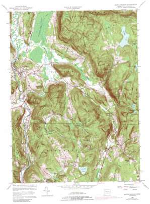
South Canaan Topo Map Connecticut
To zoom in, hover over the map of South Canaan
USGS Topo Quad 41073h3 - 1:24,000 scale
| Topo Map Name: | South Canaan |
| USGS Topo Quad ID: | 41073h3 |
| Print Size: | ca. 21 1/4" wide x 27" high |
| Southeast Coordinates: | 41.875° N latitude / 73.25° W longitude |
| Map Center Coordinates: | 41.9375° N latitude / 73.3125° W longitude |
| U.S. State: | CT |
| Filename: | o41073h3.jpg |
| Download Map JPG Image: | South Canaan topo map 1:24,000 scale |
| Map Type: | Topographic |
| Topo Series: | 7.5´ |
| Map Scale: | 1:24,000 |
| Source of Map Images: | United States Geological Survey (USGS) |
| Alternate Map Versions: |
South Canaan CT 1956, updated 1958 Download PDF Buy paper map South Canaan CT 1956, updated 1963 Download PDF Buy paper map South Canaan CT 1956, updated 1971 Download PDF Buy paper map South Canaan CT 1956, updated 1989 Download PDF Buy paper map South Canaan CT 1956, updated 1989 Download PDF Buy paper map South Canaan CT 2012 Download PDF Buy paper map South Canaan CT 2015 Download PDF Buy paper map |
1:24,000 Topo Quads surrounding South Canaan
> Back to 41073e1 at 1:100,000 scale
> Back to 41072a1 at 1:250,000 scale
> Back to U.S. Topo Maps home
South Canaan topo map: Gazetteer
South Canaan: Bays
The Cove elevation 193m 633′South Canaan: Cliffs
Lookout Point elevation 182m 597′South Canaan: Dams
Camp Freedman Pond Dam elevation 216m 708′Cream Hill Lake Dam elevation 338m 1108′
Great Falls Dam elevation 199m 652′
Wangum Lake Dam elevation 454m 1489′
Wapato Pond Dam elevation 375m 1230′
South Canaan: Falls
Great Falls elevation 196m 643′South Canaan: Forests
Housatonic State Forest elevation 349m 1145′South Canaan: Lakes
Cream Hill Lake elevation 338m 1108′Hedden Pond elevation 307m 1007′
Kellogg Pond elevation 213m 698′
Old Man McMullen Pond elevation 459m 1505′
Seldom Seen Pond elevation 458m 1502′
Wangum Lake elevation 454m 1489′
Wapato Pond elevation 375m 1230′
South Canaan: Parks
Falls Village Historic District elevation 186m 610′South Canaan: Populated Places
Falls Village elevation 196m 643′Huntsville elevation 222m 728′
Lower City elevation 251m 823′
Pine Grove elevation 210m 688′
South Canaan elevation 200m 656′
Yelping Hill elevation 425m 1394′
South Canaan: Post Offices
Falls Village Post Office elevation 205m 672′South Canaan: Reservoirs
Bear Swamp Pond elevation 384m 1259′Camp Freedman Pond elevation 216m 708′
Childs Pond elevation 209m 685′
Great Falls Reservoir elevation 199m 652′
Hollenbeck Pond elevation 243m 797′
South Canaan: Streams
Adams Brook elevation 160m 524′Bradford Brook elevation 277m 908′
Brown Brook elevation 234m 767′
Deming Brook elevation 200m 656′
Flat Brook elevation 201m 659′
Hollenbeck River elevation 194m 636′
Ledgy Brook elevation 198m 649′
North Branch Brown Brook elevation 272m 892′
Ocain Brook elevation 265m 869′
Preston Brook elevation 162m 531′
Reed Brook elevation 162m 531′
Salmon Creek elevation 162m 531′
Swamp Brook elevation 195m 639′
Wangum Lake Brook elevation 195m 639′
Wetauwanchu Brook elevation 164m 538′
Whiting Brook elevation 195m 639′
South Canaan: Summits
Barrack Mountain elevation 389m 1276′Battle Hill elevation 262m 859′
Beebe Hill elevation 317m 1040′
Bradford Mountain elevation 584m 1916′
Canaan Mountain elevation 482m 1581′
Cherry Hill elevation 354m 1161′
Cobble Hill elevation 383m 1256′
Cream Hill elevation 452m 1482′
Hough Mountain elevation 374m 1227′
Howe Mountain elevation 473m 1551′
Music Mountain elevation 381m 1250′
Pond Hill elevation 442m 1450′
Rattlesnake Hill elevation 404m 1325′
Roberts Hill elevation 436m 1430′
Rugg Hill elevation 352m 1154′
Stone Man Mountain elevation 525m 1722′
Tarradiddle elevation 377m 1236′
Titus Mountain elevation 464m 1522′
Waller Hill elevation 386m 1266′
South Canaan: Swamps
Bear Swamp elevation 395m 1295′Keep Swamp elevation 457m 1499′
Red Spruce Swamp elevation 473m 1551′
Robbins Swamp elevation 195m 639′
South Canaan: Valleys
Cream Hollow elevation 342m 1122′Dean Ravine elevation 192m 629′
Johnson Hollow elevation 284m 931′
Wildcat Hollow elevation 194m 636′
South Canaan digital topo map on disk
Buy this South Canaan topo map showing relief, roads, GPS coordinates and other geographical features, as a high-resolution digital map file on DVD:
New York, Vermont, Connecticut & Western Massachusetts
Buy digital topo maps: New York, Vermont, Connecticut & Western Massachusetts


