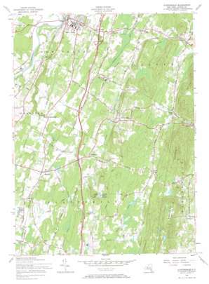
Clintondale Topo Map New York
To zoom in, hover over the map of Clintondale
USGS Topo Quad 41074f1 - 1:24,000 scale
| Topo Map Name: | Clintondale |
| USGS Topo Quad ID: | 41074f1 |
| Print Size: | ca. 21 1/4" wide x 27" high |
| Southeast Coordinates: | 41.625° N latitude / 74° W longitude |
| Map Center Coordinates: | 41.6875° N latitude / 74.0625° W longitude |
| U.S. State: | NY |
| Filename: | o41074f1.jpg |
| Download Map JPG Image: | Clintondale topo map 1:24,000 scale |
| Map Type: | Topographic |
| Topo Series: | 7.5´ |
| Map Scale: | 1:24,000 |
| Source of Map Images: | United States Geological Survey (USGS) |
| Alternate Map Versions: |
Clintondale NY 1957, updated 1958 Download PDF Buy paper map Clintondale NY 1957, updated 1968 Download PDF Buy paper map Clintondale NY 1957, updated 1968 Download PDF Buy paper map Clintondale NY 2010 Download PDF Buy paper map Clintondale NY 2013 Download PDF Buy paper map Clintondale NY 2016 Download PDF Buy paper map |
1:24,000 Topo Quads surrounding Clintondale
> Back to 41074e1 at 1:100,000 scale
> Back to 41074a1 at 1:250,000 scale
> Back to U.S. Topo Maps home
Clintondale topo map: Gazetteer
Clintondale: Airports
DuBois Landing Field (historical) elevation 118m 387′Marlboro Airport elevation 199m 652′
Minard Farms Airport elevation 140m 459′
Clintondale: Crossings
Interchange 18 elevation 116m 380′Clintondale: Lakes
Lake Sunset elevation 192m 629′Clintondale: Parks
Alumni Soccer Field elevation 97m 318′Haggerty Plaza elevation 103m 337′
Loren Campbell Baseball Field elevation 93m 305′
Clintondale: Populated Places
Ardonia elevation 166m 544′Baileys Gap elevation 155m 508′
Clintondale elevation 166m 544′
Clintondale Station elevation 120m 393′
Elting Corners elevation 113m 370′
Jenkinstown elevation 104m 341′
Lattintown elevation 130m 426′
Lloyd elevation 116m 380′
Modena elevation 139m 456′
Modena Gardens elevation 136m 446′
New Paltz elevation 73m 239′
Ohioville elevation 112m 367′
Sylva elevation 169m 554′
Tuckers Corner elevation 207m 679′
Clintondale: Streams
Pancake Hollow Brook elevation 95m 311′Clintondale: Summits
Marlboro Mountain elevation 340m 1115′Clintondale digital topo map on disk
Buy this Clintondale topo map showing relief, roads, GPS coordinates and other geographical features, as a high-resolution digital map file on DVD:
New York, Vermont, Connecticut & Western Massachusetts
Buy digital topo maps: New York, Vermont, Connecticut & Western Massachusetts


