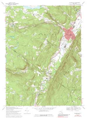
Ellenville Topo Map New York
To zoom in, hover over the map of Ellenville
USGS Topo Quad 41074f4 - 1:24,000 scale
| Topo Map Name: | Ellenville |
| USGS Topo Quad ID: | 41074f4 |
| Print Size: | ca. 21 1/4" wide x 27" high |
| Southeast Coordinates: | 41.625° N latitude / 74.375° W longitude |
| Map Center Coordinates: | 41.6875° N latitude / 74.4375° W longitude |
| U.S. State: | NY |
| Filename: | o41074f4.jpg |
| Download Map JPG Image: | Ellenville topo map 1:24,000 scale |
| Map Type: | Topographic |
| Topo Series: | 7.5´ |
| Map Scale: | 1:24,000 |
| Source of Map Images: | United States Geological Survey (USGS) |
| Alternate Map Versions: |
Ellenville NY 1942, updated 1959 Download PDF Buy paper map Ellenville NY 1942, updated 1961 Download PDF Buy paper map Ellenville NY 1969, updated 1971 Download PDF Buy paper map Ellenville NY 1969, updated 1989 Download PDF Buy paper map Ellenville NY 1969, updated 1989 Download PDF Buy paper map Ellenville NY 2010 Download PDF Buy paper map Ellenville NY 2013 Download PDF Buy paper map Ellenville NY 2016 Download PDF Buy paper map |
1:24,000 Topo Quads surrounding Ellenville
> Back to 41074e1 at 1:100,000 scale
> Back to 41074a1 at 1:250,000 scale
> Back to U.S. Topo Maps home
Ellenville topo map: Gazetteer
Ellenville: Airports
Joseph Y Resnick Airport elevation 86m 282′Ellenville: Falls
Hanging Rock Falls elevation 241m 790′Nevele Falls elevation 163m 534′
Ellenville: Lakes
Cranberry Lake elevation 338m 1108′Windsor Lake elevation 252m 826′
Ellenville: Parks
Liberty Square elevation 101m 331′Ellenville: Populated Places
Cragsmoor elevation 568m 1863′Ellenville elevation 103m 337′
Greenfield Park elevation 266m 872′
Mount Vernon elevation 470m 1541′
Phillipsport elevation 152m 498′
Spring Glen elevation 122m 400′
The Cape elevation 316m 1036′
Walker Valley elevation 202m 662′
Ellenville: Reservoirs
Cape Pond elevation 305m 1000′Nevele Lake elevation 97m 318′
Ellenville: Streams
Beer Kill elevation 91m 298′Fantine Kill elevation 88m 288′
Homowack Kill elevation 110m 360′
Leuren Kill elevation 99m 324′
North Gully elevation 157m 515′
South Gully elevation 145m 475′
West Branch Beer Kill elevation 141m 462′
Ellenville: Summits
Bear Hill elevation 593m 1945′Mount Meenahga elevation 532m 1745′
Ellenville: Swamps
Cedar Swamp elevation 344m 1128′Pine Swamp elevation 364m 1194′
Ellenville digital topo map on disk
Buy this Ellenville topo map showing relief, roads, GPS coordinates and other geographical features, as a high-resolution digital map file on DVD:
New York, Vermont, Connecticut & Western Massachusetts
Buy digital topo maps: New York, Vermont, Connecticut & Western Massachusetts


