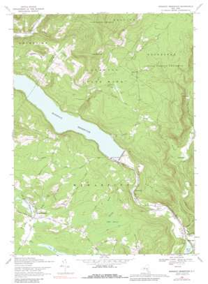
Rondout Reservoir Topo Map New York
To zoom in, hover over the map of Rondout Reservoir
USGS Topo Quad 41074g4 - 1:24,000 scale
| Topo Map Name: | Rondout Reservoir |
| USGS Topo Quad ID: | 41074g4 |
| Print Size: | ca. 21 1/4" wide x 27" high |
| Southeast Coordinates: | 41.75° N latitude / 74.375° W longitude |
| Map Center Coordinates: | 41.8125° N latitude / 74.4375° W longitude |
| U.S. State: | NY |
| Filename: | o41074g4.jpg |
| Download Map JPG Image: | Rondout Reservoir topo map 1:24,000 scale |
| Map Type: | Topographic |
| Topo Series: | 7.5´ |
| Map Scale: | 1:24,000 |
| Source of Map Images: | United States Geological Survey (USGS) |
| Alternate Map Versions: |
Lackawack NY 1942, updated 1959 Download PDF Buy paper map Rondout Reservoir NY 1969, updated 1971 Download PDF Buy paper map Rondout Reservior NY 1969, updated 1990 Download PDF Buy paper map Rondout Reservoir NY 2010 Download PDF Buy paper map Rondout Reservoir NY 2013 Download PDF Buy paper map Rondout Reservoir NY 2016 Download PDF Buy paper map |
1:24,000 Topo Quads surrounding Rondout Reservoir
> Back to 41074e1 at 1:100,000 scale
> Back to 41074a1 at 1:250,000 scale
> Back to U.S. Topo Maps home
Rondout Reservoir topo map: Gazetteer
Rondout Reservoir: Dams
Merriman Dam elevation 256m 839′Rondout Reservoir: Lakes
Ulster Heights Lake elevation 308m 1010′Rondout Reservoir: Populated Places
Brownville elevation 256m 839′Honk Hill elevation 174m 570′
Lackawack elevation 192m 629′
Potterville elevation 333m 1092′
Sholam elevation 379m 1243′
Ulster Heights elevation 324m 1062′
Yagerville elevation 443m 1453′
Rondout Reservoir: Reservoirs
Honk Lake elevation 174m 570′Rondout Reservoir elevation 250m 820′
Rondout Reservoir: Ridges
Kalonymus Escarpment elevation 423m 1387′Rondout Reservoir: Streams
Botsford Brook elevation 308m 1010′Brandy Brook elevation 189m 620′
Trout Creek elevation 256m 839′
West Branch Vernooy Kill elevation 225m 738′
Rondout Reservoir: Summits
East Mountain elevation 699m 2293′Rondout Reservoir: Swamps
Cedar Swamp elevation 320m 1049′Rondout Reservoir digital topo map on disk
Buy this Rondout Reservoir topo map showing relief, roads, GPS coordinates and other geographical features, as a high-resolution digital map file on DVD:
New York, Vermont, Connecticut & Western Massachusetts
Buy digital topo maps: New York, Vermont, Connecticut & Western Massachusetts


