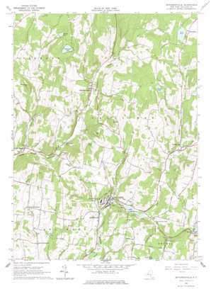
Jeffersonville Topo Map New York
To zoom in, hover over the map of Jeffersonville
USGS Topo Quad 41074g8 - 1:24,000 scale
| Topo Map Name: | Jeffersonville |
| USGS Topo Quad ID: | 41074g8 |
| Print Size: | ca. 21 1/4" wide x 27" high |
| Southeast Coordinates: | 41.75° N latitude / 74.875° W longitude |
| Map Center Coordinates: | 41.8125° N latitude / 74.9375° W longitude |
| U.S. State: | NY |
| Filename: | o41074g8.jpg |
| Download Map JPG Image: | Jeffersonville topo map 1:24,000 scale |
| Map Type: | Topographic |
| Topo Series: | 7.5´ |
| Map Scale: | 1:24,000 |
| Source of Map Images: | United States Geological Survey (USGS) |
| Alternate Map Versions: |
Jeffersonville NY 1965, updated 1967 Download PDF Buy paper map Jeffersonville NY 1965, updated 1977 Download PDF Buy paper map Jeffersonville NY 2010 Download PDF Buy paper map Jeffersonville NY 2013 Download PDF Buy paper map Jeffersonville NY 2016 Download PDF Buy paper map |
1:24,000 Topo Quads surrounding Jeffersonville
> Back to 41074e1 at 1:100,000 scale
> Back to 41074a1 at 1:250,000 scale
> Back to U.S. Topo Maps home
Jeffersonville topo map: Gazetteer
Jeffersonville: Lakes
Anawanda Lake elevation 549m 1801′Hust Pond elevation 479m 1571′
Sand Pond elevation 636m 2086′
Jeffersonville: Populated Places
Briscoe elevation 359m 1177′Callicoon Center elevation 382m 1253′
Jeffersonville elevation 320m 1049′
Kohlertown elevation 314m 1030′
Lower Beechwood elevation 398m 1305′
North Branch elevation 316m 1036′
Upper Beechwood elevation 466m 1528′
Youngsville elevation 365m 1197′
Jeffersonville: Reservoirs
Briscoe Lake elevation 363m 1190′Gossweyler Pond elevation 343m 1125′
Lake Jefferson elevation 329m 1079′
Mill Pond elevation 321m 1053′
Petrillo Lake elevation 530m 1738′
Stump Pond elevation 531m 1742′
Jeffersonville: Streams
Buck Brook elevation 303m 994′Laundry Brook elevation 317m 1040′
Panther Rock Brook elevation 356m 1167′
Sand Pond Outlet elevation 425m 1394′
The Gulf elevation 425m 1394′
Jeffersonville: Summits
Baldy elevation 464m 1522′East Hill elevation 536m 1758′
Hill 16 elevation 584m 1916′
Hust Hill elevation 588m 1929′
Mandrake Hill elevation 587m 1925′
Swiss Hill elevation 442m 1450′
Jeffersonville digital topo map on disk
Buy this Jeffersonville topo map showing relief, roads, GPS coordinates and other geographical features, as a high-resolution digital map file on DVD:
New York, Vermont, Connecticut & Western Massachusetts
Buy digital topo maps: New York, Vermont, Connecticut & Western Massachusetts


