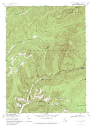
Peekamoose Mountain Topo Map New York
To zoom in, hover over the map of Peekamoose Mountain
USGS Topo Quad 41074h4 - 1:24,000 scale
| Topo Map Name: | Peekamoose Mountain |
| USGS Topo Quad ID: | 41074h4 |
| Print Size: | ca. 21 1/4" wide x 27" high |
| Southeast Coordinates: | 41.875° N latitude / 74.375° W longitude |
| Map Center Coordinates: | 41.9375° N latitude / 74.4375° W longitude |
| U.S. State: | NY |
| Filename: | o41074h4.jpg |
| Download Map JPG Image: | Peekamoose Mountain topo map 1:24,000 scale |
| Map Type: | Topographic |
| Topo Series: | 7.5´ |
| Map Scale: | 1:24,000 |
| Source of Map Images: | United States Geological Survey (USGS) |
| Alternate Map Versions: |
Peekamoose Mountain NY 1943, updated 1957 Download PDF Buy paper map Peekamoose Mountain NY 1943, updated 1960 Download PDF Buy paper map Peekamoose Mtn NY 1969, updated 1971 Download PDF Buy paper map Peekamoose Mtn NY 1969, updated 1989 Download PDF Buy paper map Peekamoose Mtn NY 1997, updated 2001 Download PDF Buy paper map Peekamoose Mountain NY 2010 Download PDF Buy paper map Peekamoose Mountain NY 2013 Download PDF Buy paper map Peekamoose Mountain NY 2016 Download PDF Buy paper map |
1:24,000 Topo Quads surrounding Peekamoose Mountain
> Back to 41074e1 at 1:100,000 scale
> Back to 41074a1 at 1:250,000 scale
> Back to U.S. Topo Maps home
Peekamoose Mountain topo map: Gazetteer
Peekamoose Mountain: Lakes
Peekamoose Lake elevation 442m 1450′Peekamoose Mountain: Populated Places
Branch elevation 660m 2165′Bull Run elevation 353m 1158′
Denning elevation 597m 1958′
Greenville elevation 615m 2017′
Peekamoose elevation 464m 1522′
Sundown elevation 312m 1023′
Peekamoose Mountain: Streams
Bear Hole Brook elevation 366m 1200′Buttermilk Falls Brook elevation 410m 1345′
Deer Shanty Brook elevation 687m 2253′
Donovan Brook elevation 706m 2316′
Erts Brook elevation 597m 1958′
Flat Brook elevation 629m 2063′
High Falls Brook elevation 323m 1059′
Riley Brook elevation 626m 2053′
Stone Cabin Brook elevation 341m 1118′
Sundown Creek elevation 298m 977′
Tray Mill Brook elevation 645m 2116′
Peekamoose Mountain: Summits
Bangle Hill elevation 715m 2345′Lone Mountain elevation 1134m 3720′
Peekamoose Mountain elevation 1172m 3845′
Samson Mountain elevation 856m 2808′
Slide Mountain elevation 1266m 4153′
Sugarloaf Mountain elevation 661m 2168′
Table Mountain elevation 1173m 3848′
Van Wyck Mountain elevation 976m 3202′
Wildcat Mountain elevation 964m 3162′
Woodhull Mountain elevation 931m 3054′
Peekamoose Mountain: Swamps
Balsam Swamp elevation 571m 1873′Peekamoose Mountain digital topo map on disk
Buy this Peekamoose Mountain topo map showing relief, roads, GPS coordinates and other geographical features, as a high-resolution digital map file on DVD:
New York, Vermont, Connecticut & Western Massachusetts
Buy digital topo maps: New York, Vermont, Connecticut & Western Massachusetts


