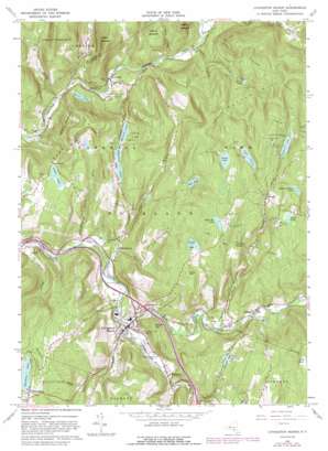
Livingston Manor Topo Map New York
To zoom in, hover over the map of Livingston Manor
USGS Topo Quad 41074h7 - 1:24,000 scale
| Topo Map Name: | Livingston Manor |
| USGS Topo Quad ID: | 41074h7 |
| Print Size: | ca. 21 1/4" wide x 27" high |
| Southeast Coordinates: | 41.875° N latitude / 74.75° W longitude |
| Map Center Coordinates: | 41.9375° N latitude / 74.8125° W longitude |
| U.S. State: | NY |
| Filename: | o41074h7.jpg |
| Download Map JPG Image: | Livingston Manor topo map 1:24,000 scale |
| Map Type: | Topographic |
| Topo Series: | 7.5´ |
| Map Scale: | 1:24,000 |
| Source of Map Images: | United States Geological Survey (USGS) |
| Alternate Map Versions: |
Livingston Manor NY 1965, updated 1967 Download PDF Buy paper map Livingston Manor NY 1965, updated 1982 Download PDF Buy paper map Livingston Manor NY 1965, updated 1989 Download PDF Buy paper map Livingston Manor NY 2010 Download PDF Buy paper map Livingston Manor NY 2013 Download PDF Buy paper map Livingston Manor NY 2016 Download PDF Buy paper map |
1:24,000 Topo Quads surrounding Livingston Manor
> Back to 41074e1 at 1:100,000 scale
> Back to 41074a1 at 1:250,000 scale
> Back to U.S. Topo Maps home
Livingston Manor topo map: Gazetteer
Livingston Manor: Bridges
Beaverkill Covered Bridge elevation 451m 1479′Van Tran Flat Bridge elevation 418m 1371′
Livingston Manor: Crossings
Interchange 96 elevation 445m 1459′Interchange 97 elevation 481m 1578′
Livingston Manor: Lakes
Clear Lake elevation 475m 1558′Edgewood Lakes elevation 574m 1883′
Forest Lake elevation 691m 2267′
Knickerbocker Pond elevation 648m 2125′
Lake Uncas elevation 636m 2086′
Lincoln Farm Lake elevation 585m 1919′
Maple Lake elevation 637m 2089′
Mud Pond elevation 645m 2116′
Orchard Lake elevation 627m 2057′
Paradise Lake elevation 428m 1404′
Quick Lake elevation 609m 1998′
Shandelee Lake elevation 634m 2080′
Trojan Lake elevation 646m 2119′
White Roe Lake elevation 673m 2208′
Livingston Manor: Populated Places
Beaverkill elevation 456m 1496′Craigie Clair elevation 429m 1407′
Deckertown elevation 440m 1443′
Grooville elevation 586m 1922′
Hazel elevation 413m 1354′
Joscelyn elevation 593m 1945′
Livingston Manor elevation 427m 1400′
Morsston elevation 439m 1440′
Parkston elevation 471m 1545′
Shandelee elevation 646m 2119′
Livingston Manor: Reservoirs
Amber Lake elevation 592m 1942′Nimrod Lake elevation 554m 1817′
Waneta Lake elevation 564m 1850′
Livingston Manor: Streams
Bascom Brook elevation 408m 1338′Berry Brook elevation 441m 1446′
Cattail Brook elevation 421m 1381′
Gee Brook elevation 506m 1660′
Hazel Brook elevation 406m 1332′
Jersey Brook elevation 461m 1512′
Little Beaver Kill elevation 421m 1381′
Mine Brook elevation 527m 1729′
Shandelee Brook elevation 516m 1692′
Sprague Brook elevation 451m 1479′
Voorhees Brook elevation 477m 1564′
Livingston Manor: Summits
Burnt Hill elevation 700m 2296′Gray Hill elevation 661m 2168′
Rattle Hill elevation 788m 2585′
Round Top elevation 557m 1827′
Livingston Manor: Valleys
Elm Hollow elevation 426m 1397′Huggins Hollow elevation 465m 1525′
Pelnor Hollow elevation 435m 1427′
Livingston Manor digital topo map on disk
Buy this Livingston Manor topo map showing relief, roads, GPS coordinates and other geographical features, as a high-resolution digital map file on DVD:
New York, Vermont, Connecticut & Western Massachusetts
Buy digital topo maps: New York, Vermont, Connecticut & Western Massachusetts


