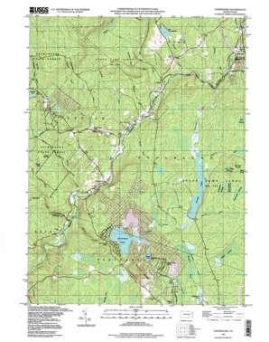
Thornhurst Topo Map Pennsylvania
To zoom in, hover over the map of Thornhurst
USGS Topo Quad 41075b5 - 1:24,000 scale
| Topo Map Name: | Thornhurst |
| USGS Topo Quad ID: | 41075b5 |
| Print Size: | ca. 21 1/4" wide x 27" high |
| Southeast Coordinates: | 41.125° N latitude / 75.5° W longitude |
| Map Center Coordinates: | 41.1875° N latitude / 75.5625° W longitude |
| U.S. State: | PA |
| Filename: | o41075b5.jpg |
| Download Map JPG Image: | Thornhurst topo map 1:24,000 scale |
| Map Type: | Topographic |
| Topo Series: | 7.5´ |
| Map Scale: | 1:24,000 |
| Source of Map Images: | United States Geological Survey (USGS) |
| Alternate Map Versions: |
Thornhurst PA 1965, updated 1967 Download PDF Buy paper map Thornhurst PA 1965, updated 1973 Download PDF Buy paper map Thornhurst PA 1965, updated 1977 Download PDF Buy paper map Thornhurst PA 1965, updated 1983 Download PDF Buy paper map Thornhurst PA 1965, updated 1994 Download PDF Buy paper map Thornhurst PA 1965, updated 1994 Download PDF Buy paper map Thornhurst PA 1976, updated 1979 Download PDF Buy paper map Thornhurst PA 1976, updated 1980 Download PDF Buy paper map Thornhurst PA 1997, updated 1998 Download PDF Buy paper map Thornhurst PA 2010 Download PDF Buy paper map Thornhurst PA 2013 Download PDF Buy paper map Thornhurst PA 2016 Download PDF Buy paper map |
1:24,000 Topo Quads surrounding Thornhurst
> Back to 41075a1 at 1:100,000 scale
> Back to 41074a1 at 1:250,000 scale
> Back to U.S. Topo Maps home
Thornhurst topo map: Gazetteer
Thornhurst: Areas
Thornhurst Picnic Area elevation 540m 1771′Thornhurst: Dams
Arrowhead Lake Dam elevation 504m 1653′Bailer Dam elevation 477m 1564′
Brady Dam elevation 522m 1712′
Bradys Lake Dam elevation 519m 1702′
North Arrowhead Lake Dam elevation 508m 1666′
Thornhurst: Lakes
East Lake elevation 525m 1722′Grassy Pond elevation 574m 1883′
Kasulaitis Lake elevation 496m 1627′
Lake Champagne elevation 545m 1788′
Nines Pond elevation 523m 1715′
Thornhurst: Parks
State Game Lands Number 135 elevation 550m 1804′Thornhurst: Populated Places
Arrowhead Lake elevation 510m 1673′Clifton elevation 495m 1624′
Locust Lakes Village elevation 542m 1778′
Thornhurst elevation 471m 1545′
Thornhurst: Reservoirs
Anglewood Lake elevation 513m 1683′Arrowhead Lake elevation 501m 1643′
Bradys Lake elevation 523m 1715′
Locust Lake elevation 522m 1712′
North Arrowhead Lake elevation 508m 1666′
Thornhurst: Ridges
Locust Ridge elevation 629m 2063′Thornhurst: Springs
Sand Spring elevation 517m 1696′Thornhurst: Streams
Ash Creek elevation 482m 1581′Blexley Run elevation 521m 1709′
Buckey Run elevation 474m 1555′
Butler Run elevation 493m 1617′
Choke Creek elevation 456m 1496′
Fenner Mill Run elevation 497m 1630′
Fritz Run elevation 522m 1712′
Hagen Run elevation 521m 1709′
Mash Creek elevation 525m 1722′
Meadow Brook elevation 544m 1784′
Pond Creek elevation 469m 1538′
Rauscher Run elevation 523m 1715′
Rucks Run elevation 517m 1696′
Sand Spring Creek elevation 463m 1519′
Silver Creek elevation 494m 1620′
Spring Run elevation 561m 1840′
Spruce Run elevation 475m 1558′
Tamarack Creek elevation 532m 1745′
Tripup Run elevation 522m 1712′
Trout Creek elevation 457m 1499′
Wolf Run elevation 475m 1558′
Thornhurst: Swamps
Bleeksley Swamp elevation 558m 1830′City of Rome Dark Swamp elevation 554m 1817′
City of Rome Swamp elevation 546m 1791′
Longpatch Swamp elevation 546m 1791′
Selfice Swamp elevation 534m 1751′
Underwood Swamp elevation 559m 1833′
Thornhurst digital topo map on disk
Buy this Thornhurst topo map showing relief, roads, GPS coordinates and other geographical features, as a high-resolution digital map file on DVD:
New York, Vermont, Connecticut & Western Massachusetts
Buy digital topo maps: New York, Vermont, Connecticut & Western Massachusetts


