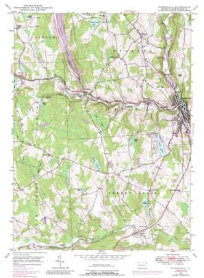
Honesdale Topo Map Pennsylvania
To zoom in, hover over the map of Honesdale
USGS Topo Quad 41075e3 - 1:24,000 scale
| Topo Map Name: | Honesdale |
| USGS Topo Quad ID: | 41075e3 |
| Print Size: | ca. 21 1/4" wide x 27" high |
| Southeast Coordinates: | 41.5° N latitude / 75.25° W longitude |
| Map Center Coordinates: | 41.5625° N latitude / 75.3125° W longitude |
| U.S. State: | PA |
| Filename: | o41075e3.jpg |
| Download Map JPG Image: | Honesdale topo map 1:24,000 scale |
| Map Type: | Topographic |
| Topo Series: | 7.5´ |
| Map Scale: | 1:24,000 |
| Source of Map Images: | United States Geological Survey (USGS) |
| Alternate Map Versions: |
Honesdale PA 1946, updated 1967 Download PDF Buy paper map Honesdale PA 1946, updated 1971 Download PDF Buy paper map Honesdale PA 1946, updated 1976 Download PDF Buy paper map Honesdale PA 1946, updated 1989 Download PDF Buy paper map Honesdale PA 1949, updated 1949 Download PDF Buy paper map Honesdale PA 1999, updated 2002 Download PDF Buy paper map Honesdale PA 2010 Download PDF Buy paper map Honesdale PA 2013 Download PDF Buy paper map Honesdale PA 2016 Download PDF Buy paper map |
1:24,000 Topo Quads surrounding Honesdale
> Back to 41075e1 at 1:100,000 scale
> Back to 41074a1 at 1:250,000 scale
> Back to U.S. Topo Maps home
Honesdale topo map: Gazetteer
Honesdale: Airports
Cavage Airport elevation 420m 1377′Honesdale: Dams
Cadjaw Dam elevation 399m 1309′Cadjaw Pond Dam elevation 399m 1309′
Collins Pond Dam elevation 358m 1174′
General Edgar Jadwin Dam elevation 322m 1056′
Glass Pond Dam Number One elevation 434m 1423′
Glass Pond Number Two Dam elevation 443m 1453′
Keen Lake Dam elevation 387m 1269′
Mican Dam elevation 409m 1341′
Prompton Dam elevation 346m 1135′
Reining Dam elevation 395m 1295′
Richard Dam elevation 393m 1289′
Texas Rod Gun Club Dam elevation 356m 1167′
Woolen Mill Dam elevation 311m 1020′
Honesdale: Lakes
Burns Pond elevation 430m 1410′Crockenburg Pond elevation 432m 1417′
Gredlein Pond elevation 399m 1309′
Honesdale: Parks
Prompton State Park elevation 393m 1289′Honesdale: Populated Places
Beech Grove elevation 432m 1417′Bethany elevation 422m 1384′
Cherry Ridge elevation 374m 1227′
Clemo elevation 365m 1197′
Coggins Corner elevation 445m 1459′
Fermoy elevation 425m 1394′
Fortenia elevation 321m 1053′
Hoadleys elevation 360m 1181′
Honesdale elevation 297m 974′
Keen elevation 394m 1292′
Prompton elevation 335m 1099′
Seelyville elevation 317m 1040′
Steene elevation 369m 1210′
Honesdale: Reservoirs
Cadjaw Pond elevation 403m 1322′Glass Pond Number One elevation 433m 1420′
Glass Pond Number Two elevation 452m 1482′
Keen Lake elevation 397m 1302′
Lake Wanoka elevation 353m 1158′
Mican Pond elevation 413m 1354′
Prompton Lake elevation 360m 1181′
Reining Pond elevation 397m 1302′
Texas Rod Gun Club Lake elevation 356m 1167′
Honesdale: Streams
Collins Brook elevation 350m 1148′Dyberry Creek elevation 293m 961′
Headley Brook elevation 348m 1141′
Mile Brook elevation 357m 1171′
Pond Brook elevation 352m 1154′
Van Auken Creek elevation 330m 1082′
West Branch Lackawaxen River elevation 330m 1082′
Honesdale: Summits
Golf Hill elevation 408m 1338′Watts Hill elevation 389m 1276′
Honesdale: Swamps
Bear Swamp elevation 413m 1354′Wilder Swamp elevation 396m 1299′
Honesdale digital topo map on disk
Buy this Honesdale topo map showing relief, roads, GPS coordinates and other geographical features, as a high-resolution digital map file on DVD:
New York, Vermont, Connecticut & Western Massachusetts
Buy digital topo maps: New York, Vermont, Connecticut & Western Massachusetts


