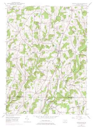
Springville Topo Map Pennsylvania
To zoom in, hover over the map of Springville
USGS Topo Quad 41075f8 - 1:24,000 scale
| Topo Map Name: | Springville |
| USGS Topo Quad ID: | 41075f8 |
| Print Size: | ca. 21 1/4" wide x 27" high |
| Southeast Coordinates: | 41.625° N latitude / 75.875° W longitude |
| Map Center Coordinates: | 41.6875° N latitude / 75.9375° W longitude |
| U.S. State: | PA |
| Filename: | o41075f8.jpg |
| Download Map JPG Image: | Springville topo map 1:24,000 scale |
| Map Type: | Topographic |
| Topo Series: | 7.5´ |
| Map Scale: | 1:24,000 |
| Source of Map Images: | United States Geological Survey (USGS) |
| Alternate Map Versions: |
Springville PA 1946, updated 1971 Download PDF Buy paper map Springville PA 1946, updated 1977 Download PDF Buy paper map Springville PA 1948 Download PDF Buy paper map Springville PA 1948 Download PDF Buy paper map Springville PA 2010 Download PDF Buy paper map Springville PA 2013 Download PDF Buy paper map Springville PA 2016 Download PDF Buy paper map |
1:24,000 Topo Quads surrounding Springville
> Back to 41075e1 at 1:100,000 scale
> Back to 41074a1 at 1:250,000 scale
> Back to U.S. Topo Maps home
Springville topo map: Gazetteer
Springville: Dams
Lake Walter Dam elevation 336m 1102′Pa-Rc and D-105 Dam elevation 381m 1250′
Springville: Lakes
Broadhead Pond elevation 385m 1263′Gardners Pond elevation 342m 1122′
Hall Pond elevation 368m 1207′
Lake Crystella elevation 397m 1302′
Pollywog Pond elevation 387m 1269′
States Mill Pond elevation 307m 1007′
Springville: Populated Places
Auburn Four Corners elevation 387m 1269′Avery elevation 323m 1059′
Dimock elevation 460m 1509′
East Lynn elevation 304m 997′
Lymanville elevation 348m 1141′
Lynn elevation 366m 1200′
Springville elevation 351m 1151′
Tyler elevation 422m 1384′
Woodhouse elevation 428m 1404′
Springville: Reservoirs
Lake Walter elevation 336m 1102′Thomas Pond elevation 378m 1240′
Springville: Streams
North Branch Meshoppen Creek elevation 287m 941′Pond Brook elevation 300m 984′
Stevens Creek elevation 305m 1000′
Thomas Creek elevation 284m 931′
West Creek elevation 302m 990′
White Creek elevation 250m 820′
Springville: Summits
Avery Hill elevation 374m 1227′Craig Hill elevation 355m 1164′
Dean Hill elevation 470m 1541′
Ellsworth Hill elevation 383m 1256′
Fish Hill elevation 414m 1358′
Gobblers Knob elevation 424m 1391′
Jennings Hill elevation 430m 1410′
Luce Hill elevation 410m 1345′
Meachem Hill elevation 410m 1345′
Mitchell Hill elevation 426m 1397′
Round Top elevation 427m 1400′
Seely Hill elevation 388m 1272′
Sheldon Hill elevation 396m 1299′
Strickland Hill elevation 427m 1400′
Taylor Hill elevation 358m 1174′
Tyler Hill elevation 430m 1410′
Wallace Hill elevation 376m 1233′
Springville: Valleys
Dark Hollow elevation 353m 1158′Negro Hollow elevation 340m 1115′
Springville digital topo map on disk
Buy this Springville topo map showing relief, roads, GPS coordinates and other geographical features, as a high-resolution digital map file on DVD:
New York, Vermont, Connecticut & Western Massachusetts
Buy digital topo maps: New York, Vermont, Connecticut & Western Massachusetts


