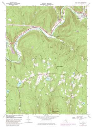
Fishs Eddy Topo Map New York
To zoom in, hover over the map of Fishs Eddy
USGS Topo Quad 41075h2 - 1:24,000 scale
| Topo Map Name: | Fishs Eddy |
| USGS Topo Quad ID: | 41075h2 |
| Print Size: | ca. 21 1/4" wide x 27" high |
| Southeast Coordinates: | 41.875° N latitude / 75.125° W longitude |
| Map Center Coordinates: | 41.9375° N latitude / 75.1875° W longitude |
| U.S. State: | NY |
| Filename: | o41075h2.jpg |
| Download Map JPG Image: | Fishs Eddy topo map 1:24,000 scale |
| Map Type: | Topographic |
| Topo Series: | 7.5´ |
| Map Scale: | 1:24,000 |
| Source of Map Images: | United States Geological Survey (USGS) |
| Alternate Map Versions: |
Fishs Eddy NY 1965, updated 1968 Download PDF Buy paper map Fishs Eddy NY 1965, updated 1982 Download PDF Buy paper map Fishs Eddy NY 2010 Download PDF Buy paper map Fishs Eddy NY 2013 Download PDF Buy paper map Fishs Eddy NY 2016 Download PDF Buy paper map |
1:24,000 Topo Quads surrounding Fishs Eddy
> Back to 41075e1 at 1:100,000 scale
> Back to 41074a1 at 1:250,000 scale
> Back to U.S. Topo Maps home
Fishs Eddy topo map: Gazetteer
Fishs Eddy: Flats
Earlys Flat elevation 304m 997′Green Flats elevation 281m 921′
Fishs Eddy: Islands
Hawk Island elevation 306m 1003′Lakins Island elevation 280m 918′
Partridge Island elevation 287m 941′
Peas Eddy Island elevation 290m 951′
Fishs Eddy: Lakes
Delaware Lake elevation 520m 1706′Pierce Pond elevation 484m 1587′
Sand Pond elevation 451m 1479′
Somerset Lake elevation 470m 1541′
Fishs Eddy: Mines
Hancock Quarry elevation 344m 1128′Fishs Eddy: Populated Places
East Branch elevation 307m 1007′Fishs Eddy elevation 300m 984′
French Woods elevation 491m 1610′
Luzerne elevation 369m 1210′
Pacatacan (historical) elevation 307m 1007′
Pea Brook elevation 417m 1368′
Peas Eddy elevation 286m 938′
Fishs Eddy: Streams
Beaver Kill elevation 299m 980′Bolton Brook elevation 300m 984′
City Brook elevation 289m 948′
Fish Creek elevation 287m 941′
Gee Brook elevation 278m 912′
Lakin Brook elevation 358m 1174′
Peas Eddy Brook elevation 281m 921′
Read Creek elevation 293m 961′
Fishs Eddy: Summits
Bittersweet Hill elevation 679m 2227′Bouchoux Hill elevation 538m 1765′
Elm Tree Ridge elevation 655m 2148′
Johnny Ridge elevation 595m 1952′
Rattlesnake Hill elevation 563m 1847′
Taylor Hill elevation 563m 1847′
Fishs Eddy: Swamps
Black Ash Swamp elevation 415m 1361′Cranberry Marsh elevation 468m 1535′
Dunn Swamp elevation 425m 1394′
Elm Swamp elevation 497m 1630′
Orleans Swamp elevation 558m 1830′
Fishs Eddy: Valleys
Big Hollow elevation 384m 1259′Brady Hollow elevation 289m 948′
Dark Hollow elevation 291m 954′
Deerlick Hollow elevation 370m 1213′
Eel Weir Hollow elevation 285m 935′
Fourth Hollow elevation 395m 1295′
Maynard Hollow elevation 332m 1089′
Nancokus Hollow elevation 293m 961′
Pond Hollow elevation 310m 1017′
Stony Hollow elevation 288m 944′
Tar Hollow elevation 297m 974′
Wheeler Hollow elevation 310m 1017′
Fishs Eddy digital topo map on disk
Buy this Fishs Eddy topo map showing relief, roads, GPS coordinates and other geographical features, as a high-resolution digital map file on DVD:
New York, Vermont, Connecticut & Western Massachusetts
Buy digital topo maps: New York, Vermont, Connecticut & Western Massachusetts


