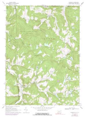
Starrucca Topo Map Pennsylvania
To zoom in, hover over the map of Starrucca
USGS Topo Quad 41075h4 - 1:24,000 scale
| Topo Map Name: | Starrucca |
| USGS Topo Quad ID: | 41075h4 |
| Print Size: | ca. 21 1/4" wide x 27" high |
| Southeast Coordinates: | 41.875° N latitude / 75.375° W longitude |
| Map Center Coordinates: | 41.9375° N latitude / 75.4375° W longitude |
| U.S. States: | PA, NY |
| Filename: | o41075h4.jpg |
| Download Map JPG Image: | Starrucca topo map 1:24,000 scale |
| Map Type: | Topographic |
| Topo Series: | 7.5´ |
| Map Scale: | 1:24,000 |
| Source of Map Images: | United States Geological Survey (USGS) |
| Alternate Map Versions: |
Starrucca PA 1968, updated 1971 Download PDF Buy paper map Starrucca PA 1968, updated 1978 Download PDF Buy paper map Starrucca PA 1968, updated 1991 Download PDF Buy paper map Starrucca PA 2010 Download PDF Buy paper map Starrucca PA 2013 Download PDF Buy paper map Starrucca PA 2016 Download PDF Buy paper map |
1:24,000 Topo Quads surrounding Starrucca
> Back to 41075e1 at 1:100,000 scale
> Back to 41074a1 at 1:250,000 scale
> Back to U.S. Topo Maps home
Starrucca topo map: Gazetteer
Starrucca: Dams
Beaver Pond Dam elevation 504m 1653′Shehawken Dam elevation 534m 1751′
Starrucca: Falls
Bucks Falls elevation 426m 1397′Starrucca: Flats
Beaver Meadow elevation 442m 1450′Starrucca: Lakes
Island Lake elevation 558m 1830′Mach Pond elevation 522m 1712′
Pine Swamp Pond elevation 435m 1427′
Shehawken Lake elevation 547m 1794′
Star Pond elevation 481m 1578′
Starrucca: Parks
State Game Lands Number 299 elevation 525m 1722′State Game Lands Number 70 elevation 525m 1722′
Starrucca: Populated Places
Fairmount elevation 555m 1820′Maple Grove elevation 555m 1820′
Scott Center elevation 431m 1414′
Shehawken elevation 558m 1830′
Sherman elevation 357m 1171′
Starrucca elevation 400m 1312′
Starrucca: Reservoirs
Beaver Pond elevation 491m 1610′Island Pond elevation 562m 1843′
Lake Shehawken elevation 534m 1751′
Starrucca: Streams
Merrigan Creek elevation 426m 1397′Shadigee Creek elevation 396m 1299′
Starboard Creek elevation 340m 1115′
Starboard Creek elevation 340m 1115′
Tarbox Brook elevation 402m 1318′
Starrucca: Summits
Maple Hill elevation 604m 1981′Penn Hill elevation 586m 1922′
Shrawder Mountain elevation 637m 2089′
Slocum Hill elevation 568m 1863′
Starrucca: Swamps
Pine Swamp elevation 436m 1430′Starrucca: Valleys
Cat Hollow elevation 320m 1049′Starrucca digital topo map on disk
Buy this Starrucca topo map showing relief, roads, GPS coordinates and other geographical features, as a high-resolution digital map file on DVD:
New York, Vermont, Connecticut & Western Massachusetts
Buy digital topo maps: New York, Vermont, Connecticut & Western Massachusetts


