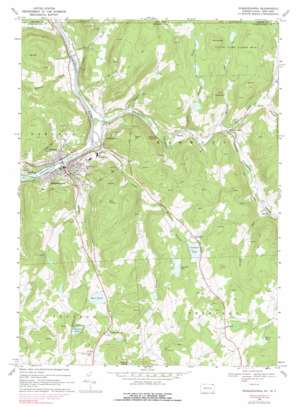
Susquehanna Topo Map Pennsylvania
To zoom in, hover over the map of Susquehanna
USGS Topo Quad 41075h5 - 1:24,000 scale
| Topo Map Name: | Susquehanna |
| USGS Topo Quad ID: | 41075h5 |
| Print Size: | ca. 21 1/4" wide x 27" high |
| Southeast Coordinates: | 41.875° N latitude / 75.5° W longitude |
| Map Center Coordinates: | 41.9375° N latitude / 75.5625° W longitude |
| U.S. States: | PA, NY |
| Filename: | o41075h5.jpg |
| Download Map JPG Image: | Susquehanna topo map 1:24,000 scale |
| Map Type: | Topographic |
| Topo Series: | 7.5´ |
| Map Scale: | 1:24,000 |
| Source of Map Images: | United States Geological Survey (USGS) |
| Alternate Map Versions: |
Susquehanna PA 1968, updated 1970 Download PDF Buy paper map Susquehanna PA 1968, updated 1977 Download PDF Buy paper map Susquehanna PA 1968, updated 1978 Download PDF Buy paper map Susquehanna PA 1968, updated 1991 Download PDF Buy paper map Susquehanna PA 1994, updated 1995 Download PDF Buy paper map Susquehanna PA 2010 Download PDF Buy paper map Susquehanna PA 2013 Download PDF Buy paper map Susquehanna PA 2016 Download PDF Buy paper map |
1:24,000 Topo Quads surrounding Susquehanna
> Back to 41075e1 at 1:100,000 scale
> Back to 41074a1 at 1:250,000 scale
> Back to U.S. Topo Maps home
Susquehanna topo map: Gazetteer
Susquehanna: Dams
Comfort Lake elevation 445m 1459′Foxton Lake Dam elevation 498m 1633′
Oakland Dam elevation 269m 882′
Ross Pond elevation 427m 1400′
Susquehanna: Lakes
Churchill Lake elevation 445m 1459′Devils Punch Bowl elevation 325m 1066′
Weirs Pond elevation 506m 1660′
Susquehanna: Populated Places
Brandt elevation 314m 1030′Jefferson Junction elevation 300m 984′
Lanesboro elevation 280m 918′
Melrose elevation 358m 1174′
North Jackson elevation 476m 1561′
Oakland elevation 286m 938′
Stevens Point elevation 335m 1099′
Susquehanna elevation 285m 935′
Susquehanna: Post Offices
Susquehanna Post Office (historical) elevation 285m 935′Susquehanna: Reservoirs
Comfort Lake elevation 439m 1440′Foxton Lake elevation 488m 1601′
Ross Pond elevation 428m 1404′
Susquehanna: Streams
Canawacta Creek elevation 274m 898′Cascade Creek elevation 275m 902′
Cascade Creek elevation 276m 905′
Deep Hollow Brook elevation 391m 1282′
Drinker Creek elevation 274m 898′
East Branch Canawacta Creek elevation 336m 1102′
East Branch Hemlock Creek elevation 365m 1197′
Hemlock Creek elevation 329m 1079′
Hilborn Creek elevation 270m 885′
Lewis Creek elevation 262m 859′
Little Roaring Brook elevation 310m 1017′
North Branch Hemlock Creek elevation 366m 1200′
North Branch Hemlock Creek elevation 366m 1200′
Pigpen Creek elevation 282m 925′
Roaring Run elevation 328m 1076′
South Branch Canawacta Creek elevation 348m 1141′
Starrucca Creek elevation 274m 898′
Wildcat Run elevation 356m 1167′
Susquehanna: Summits
King Hill elevation 506m 1660′Oak Hill elevation 525m 1722′
Round Hill elevation 567m 1860′
Taylor Hill elevation 522m 1712′
Susquehanna: Swamps
Bear Swamp elevation 424m 1391′Susquehanna digital topo map on disk
Buy this Susquehanna topo map showing relief, roads, GPS coordinates and other geographical features, as a high-resolution digital map file on DVD:
New York, Vermont, Connecticut & Western Massachusetts
Buy digital topo maps: New York, Vermont, Connecticut & Western Massachusetts


