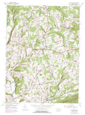
Stillwater Topo Map Pennsylvania
To zoom in, hover over the map of Stillwater
USGS Topo Quad 41076b3 - 1:24,000 scale
| Topo Map Name: | Stillwater |
| USGS Topo Quad ID: | 41076b3 |
| Print Size: | ca. 21 1/4" wide x 27" high |
| Southeast Coordinates: | 41.125° N latitude / 76.25° W longitude |
| Map Center Coordinates: | 41.1875° N latitude / 76.3125° W longitude |
| U.S. State: | PA |
| Filename: | o41076b3.jpg |
| Download Map JPG Image: | Stillwater topo map 1:24,000 scale |
| Map Type: | Topographic |
| Topo Series: | 7.5´ |
| Map Scale: | 1:24,000 |
| Source of Map Images: | United States Geological Survey (USGS) |
| Alternate Map Versions: |
Stillwater PA 1947 Download PDF Buy paper map Stillwater PA 1947 Download PDF Buy paper map Stillwater PA 1954, updated 1955 Download PDF Buy paper map Stillwater PA 1954, updated 1971 Download PDF Buy paper map Stillwater PA 1954, updated 1978 Download PDF Buy paper map Stillwater PA 1954, updated 1991 Download PDF Buy paper map Stillwater PA 2010 Download PDF Buy paper map Stillwater PA 2013 Download PDF Buy paper map Stillwater PA 2016 Download PDF Buy paper map |
1:24,000 Topo Quads surrounding Stillwater
> Back to 41076a1 at 1:100,000 scale
> Back to 41076a1 at 1:250,000 scale
> Back to U.S. Topo Maps home
Stillwater topo map: Gazetteer
Stillwater: Lakes
Foss Pond elevation 361m 1184′Stillwater: Populated Places
Asbury elevation 259m 849′Bendertown elevation 291m 954′
Cambra elevation 313m 1026′
Clarks View elevation 276m 905′
Coles Creek elevation 264m 866′
Fairmount Springs elevation 367m 1204′
Five Points elevation 404m 1325′
Honeytown elevation 301m 987′
Jonestown elevation 212m 695′
Marshall Hollow elevation 273m 895′
New Columbus elevation 302m 990′
Register elevation 247m 810′
Southdale elevation 285m 935′
Stillwater elevation 212m 695′
Town Hill elevation 304m 997′
Zaner elevation 201m 659′
Stillwater: Streams
Ashs West Branch elevation 266m 872′Bell Creek elevation 254m 833′
Coles Creek elevation 258m 846′
East Branch Raven Creek elevation 237m 777′
Kingsbury Brook elevation 210m 688′
Little Pine Creek elevation 219m 718′
Pine Creek elevation 207m 679′
Raven Creek elevation 209m 685′
Spring Branch elevation 248m 813′
Wasp Branch elevation 297m 974′
Stillwater: Summits
Cherry Hill elevation 320m 1049′Creveling Hill elevation 378m 1240′
Hess Hill elevation 337m 1105′
Line Hill elevation 435m 1427′
Long Hill elevation 412m 1351′
Saint Gabriel Hill elevation 405m 1328′
Tubbs Hill elevation 361m 1184′
Stillwater: Swamps
Bear Swamp elevation 289m 948′Grisco Swamp elevation 381m 1250′
Wenner Swamp elevation 332m 1089′
Stillwater: Valleys
Bee Sellers Hollow elevation 211m 692′Karnes Hollow elevation 222m 728′
Karnes Hollow elevation 237m 777′
Stine Hollow elevation 249m 816′
Stillwater digital topo map on disk
Buy this Stillwater topo map showing relief, roads, GPS coordinates and other geographical features, as a high-resolution digital map file on DVD:
New York, Vermont, Connecticut & Western Massachusetts
Buy digital topo maps: New York, Vermont, Connecticut & Western Massachusetts


