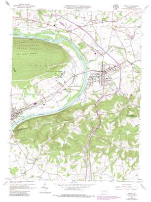
Muncy Topo Map Pennsylvania
To zoom in, hover over the map of Muncy
USGS Topo Quad 41076b7 - 1:24,000 scale
| Topo Map Name: | Muncy |
| USGS Topo Quad ID: | 41076b7 |
| Print Size: | ca. 21 1/4" wide x 27" high |
| Southeast Coordinates: | 41.125° N latitude / 76.75° W longitude |
| Map Center Coordinates: | 41.1875° N latitude / 76.8125° W longitude |
| U.S. State: | PA |
| Filename: | o41076b7.jpg |
| Download Map JPG Image: | Muncy topo map 1:24,000 scale |
| Map Type: | Topographic |
| Topo Series: | 7.5´ |
| Map Scale: | 1:24,000 |
| Source of Map Images: | United States Geological Survey (USGS) |
| Alternate Map Versions: |
Muncy PA 1965, updated 1967 Download PDF Buy paper map Muncy PA 1965, updated 1973 Download PDF Buy paper map Muncy PA 1965, updated 1986 Download PDF Buy paper map Muncy PA 1965, updated 1986 Download PDF Buy paper map Muncy PA 2010 Download PDF Buy paper map Muncy PA 2013 Download PDF Buy paper map Muncy PA 2016 Download PDF Buy paper map |
1:24,000 Topo Quads surrounding Muncy
> Back to 41076a1 at 1:100,000 scale
> Back to 41076a1 at 1:250,000 scale
> Back to U.S. Topo Maps home
Muncy topo map: Gazetteer
Muncy: Airports
Hey Field elevation 169m 554′Muncy: Islands
King Island elevation 147m 482′Muncy: Populated Places
Chippewa elevation 182m 597′Delaware Run elevation 163m 534′
Lime Bluff elevation 165m 541′
Muncy elevation 152m 498′
Pennsdale elevation 164m 538′
Saegers elevation 156m 511′
Muncy: Reservoirs
Muncy Reservoir elevation 201m 659′Muncy: Streams
Carpenters Run elevation 158m 518′Dry Run elevation 157m 515′
Glade Run elevation 146m 479′
Margaret Run elevation 153m 501′
Oak Run elevation 163m 534′
Tules Run elevation 146m 479′
Turkey Run elevation 151m 495′
Turkey Run elevation 141m 462′
Twin Run elevation 146m 479′
Wolf Run elevation 143m 469′
Muncy digital topo map on disk
Buy this Muncy topo map showing relief, roads, GPS coordinates and other geographical features, as a high-resolution digital map file on DVD:
New York, Vermont, Connecticut & Western Massachusetts
Buy digital topo maps: New York, Vermont, Connecticut & Western Massachusetts


