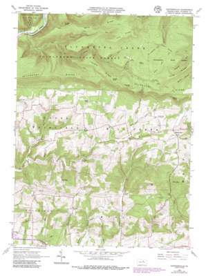
Huntersville Topo Map Pennsylvania
To zoom in, hover over the map of Huntersville
USGS Topo Quad 41076c7 - 1:24,000 scale
| Topo Map Name: | Huntersville |
| USGS Topo Quad ID: | 41076c7 |
| Print Size: | ca. 21 1/4" wide x 27" high |
| Southeast Coordinates: | 41.25° N latitude / 76.75° W longitude |
| Map Center Coordinates: | 41.3125° N latitude / 76.8125° W longitude |
| U.S. State: | PA |
| Filename: | o41076c7.jpg |
| Download Map JPG Image: | Huntersville topo map 1:24,000 scale |
| Map Type: | Topographic |
| Topo Series: | 7.5´ |
| Map Scale: | 1:24,000 |
| Source of Map Images: | United States Geological Survey (USGS) |
| Alternate Map Versions: |
Huntersville PA 1965, updated 1967 Download PDF Buy paper map Huntersville PA 1965, updated 1973 Download PDF Buy paper map Huntersville PA 1965, updated 1986 Download PDF Buy paper map Huntersville PA 1965, updated 1986 Download PDF Buy paper map Huntersville PA 2010 Download PDF Buy paper map Huntersville PA 2013 Download PDF Buy paper map Huntersville PA 2016 Download PDF Buy paper map |
1:24,000 Topo Quads surrounding Huntersville
> Back to 41076a1 at 1:100,000 scale
> Back to 41076a1 at 1:250,000 scale
> Back to U.S. Topo Maps home
Huntersville topo map: Gazetteer
Huntersville: Populated Places
Dewey Corner elevation 349m 1145′Huntersville elevation 342m 1122′
Huntersville: Ridges
Allegheny Ridge elevation 636m 2086′Long Ridge elevation 595m 1952′
Red Ridge elevation 628m 2060′
Rock Ridge elevation 635m 2083′
Tarkiln Ridge elevation 618m 2027′
Huntersville: Springs
Sand Spring elevation 572m 1876′Huntersville: Streams
Bear Creek elevation 262m 859′Dry Run elevation 171m 561′
Little Mill Creek elevation 198m 649′
Little Painter Run elevation 198m 649′
Pine Run elevation 291m 954′
Red Run elevation 435m 1427′
Rush Run elevation 272m 892′
Sand Spring Run elevation 501m 1643′
Huntersville: Summits
Burns Knob elevation 565m 1853′Dickey Knob elevation 618m 2027′
Long Hill elevation 433m 1420′
Roundtop elevation 427m 1400′
Smiths Knob elevation 587m 1925′
Smiths Knob Vista elevation 580m 1902′
Stimets Knob elevation 636m 2086′
Huntersville: Trails
Bushy Ridge Trail elevation 577m 1893′Graff Woolever Trail elevation 327m 1072′
Grandad Trail elevation 506m 1660′
Jordan Trail elevation 505m 1656′
Little Grandad Run Trail elevation 531m 1742′
Miller Trail elevation 565m 1853′
Painter Trail elevation 345m 1131′
Peters Path elevation 486m 1594′
Red Ridge Trail elevation 628m 2060′
Huntersville: Valleys
Bar Bottom Hollow elevation 201m 659′Huntersville digital topo map on disk
Buy this Huntersville topo map showing relief, roads, GPS coordinates and other geographical features, as a high-resolution digital map file on DVD:
New York, Vermont, Connecticut & Western Massachusetts
Buy digital topo maps: New York, Vermont, Connecticut & Western Massachusetts


