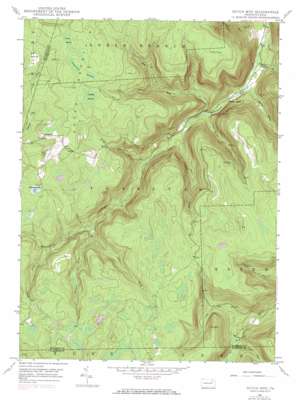
Dutch Mountain Topo Map Pennsylvania
To zoom in, hover over the map of Dutch Mountain
USGS Topo Quad 41076d2 - 1:24,000 scale
| Topo Map Name: | Dutch Mountain |
| USGS Topo Quad ID: | 41076d2 |
| Print Size: | ca. 21 1/4" wide x 27" high |
| Southeast Coordinates: | 41.375° N latitude / 76.125° W longitude |
| Map Center Coordinates: | 41.4375° N latitude / 76.1875° W longitude |
| U.S. State: | PA |
| Filename: | o41076d2.jpg |
| Download Map JPG Image: | Dutch Mountain topo map 1:24,000 scale |
| Map Type: | Topographic |
| Topo Series: | 7.5´ |
| Map Scale: | 1:24,000 |
| Source of Map Images: | United States Geological Survey (USGS) |
| Alternate Map Versions: |
Dutch Mtn PA 1946, updated 1960 Download PDF Buy paper map Dutch Mtn PA 1946, updated 1971 Download PDF Buy paper map Dutch Mtn PA 1946, updated 1971 Download PDF Buy paper map Dutch Mtn PA 1948 Download PDF Buy paper map Dutch Mtn. PA 1948 Download PDF Buy paper map Dutch Mtn PA 1997, updated 1999 Download PDF Buy paper map Dutch Mountain PA 2010 Download PDF Buy paper map Dutch Mountain PA 2013 Download PDF Buy paper map Dutch Mountain PA 2016 Download PDF Buy paper map |
1:24,000 Topo Quads surrounding Dutch Mountain
> Back to 41076a1 at 1:100,000 scale
> Back to 41076a1 at 1:250,000 scale
> Back to U.S. Topo Maps home
Dutch Mountain topo map: Gazetteer
Dutch Mountain: Lakes
Schmitthenner Lake elevation 610m 2001′Dutch Mountain: Pillars
The Stack elevation 660m 2165′Dutch Mountain: Populated Places
Bellasylva elevation 646m 2119′Kasson Brook elevation 313m 1026′
Dutch Mountain: Streams
Becker Brook elevation 387m 1269′Bellas Brook elevation 526m 1725′
Cider Run elevation 416m 1364′
Henry Lott Brook elevation 327m 1072′
Kasson Brook elevation 303m 994′
Opossum Brook elevation 473m 1551′
Red Brook elevation 469m 1538′
Scouten Brook elevation 291m 954′
Somer Brook elevation 350m 1148′
South Brook elevation 468m 1535′
Stony Brook elevation 330m 1082′
Sugar Run elevation 414m 1358′
White Brook elevation 269m 882′
Dutch Mountain: Summits
Dutch Mountain elevation 695m 2280′Flat Top elevation 685m 2247′
Short Mountain elevation 640m 2099′
Dutch Mountain: Swamps
Coalbed Swamp elevation 674m 2211′Crane Swamp elevation 687m 2253′
Tamarack Swamp elevation 681m 2234′
Dutch Mountain digital topo map on disk
Buy this Dutch Mountain topo map showing relief, roads, GPS coordinates and other geographical features, as a high-resolution digital map file on DVD:
New York, Vermont, Connecticut & Western Massachusetts
Buy digital topo maps: New York, Vermont, Connecticut & Western Massachusetts


