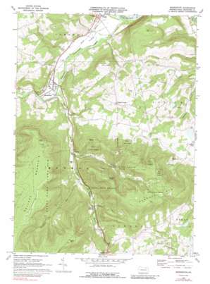
Monroeton Topo Map Pennsylvania
To zoom in, hover over the map of Monroeton
USGS Topo Quad 41076f4 - 1:24,000 scale
| Topo Map Name: | Monroeton |
| USGS Topo Quad ID: | 41076f4 |
| Print Size: | ca. 21 1/4" wide x 27" high |
| Southeast Coordinates: | 41.625° N latitude / 76.375° W longitude |
| Map Center Coordinates: | 41.6875° N latitude / 76.4375° W longitude |
| U.S. State: | PA |
| Filename: | o41076f4.jpg |
| Download Map JPG Image: | Monroeton topo map 1:24,000 scale |
| Map Type: | Topographic |
| Topo Series: | 7.5´ |
| Map Scale: | 1:24,000 |
| Source of Map Images: | United States Geological Survey (USGS) |
| Alternate Map Versions: |
Monroeton PA 1969, updated 1973 Download PDF Buy paper map Monroeton PA 1969, updated 1979 Download PDF Buy paper map Monroeton PA 1969, updated 1988 Download PDF Buy paper map Monroeton PA 1969, updated 1988 Download PDF Buy paper map Monroeton PA 1999, updated 2001 Download PDF Buy paper map Monroeton PA 2010 Download PDF Buy paper map Monroeton PA 2013 Download PDF Buy paper map Monroeton PA 2016 Download PDF Buy paper map |
1:24,000 Topo Quads surrounding Monroeton
> Back to 41076e1 at 1:100,000 scale
> Back to 41076a1 at 1:250,000 scale
> Back to U.S. Topo Maps home
Monroeton topo map: Gazetteer
Monroeton: Airports
Towanda Airport elevation 219m 718′Monroeton: Flats
Towanda Flats elevation 220m 721′Monroeton: Parks
State Game Lands Number 240 elevation 586m 1922′Monroeton: Populated Places
Kellogg elevation 270m 885′Marshview elevation 371m 1217′
Monroeton elevation 234m 767′
South Branch elevation 306m 1003′
Uhdey elevation 371m 1217′
Monroeton: Streams
Fenner Run elevation 298m 977′Kent Run elevation 268m 879′
Satterlee Run elevation 283m 928′
South Branch Towanda Creek elevation 230m 754′
Towanda Creek elevation 211m 692′
Monroeton: Summits
Hale Mountain elevation 446m 1463′Hatch Mountain elevation 704m 2309′
Kellogg Mountain elevation 649m 2129′
Marcy Point elevation 555m 1820′
Nichols Point elevation 661m 2168′
Robwood Mountain elevation 714m 2342′
Round Top elevation 648m 2125′
Tip Top elevation 457m 1499′
Monroeton digital topo map on disk
Buy this Monroeton topo map showing relief, roads, GPS coordinates and other geographical features, as a high-resolution digital map file on DVD:
New York, Vermont, Connecticut & Western Massachusetts
Buy digital topo maps: New York, Vermont, Connecticut & Western Massachusetts


