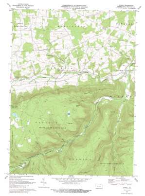
Powell Topo Map Pennsylvania
To zoom in, hover over the map of Powell
USGS Topo Quad 41076f5 - 1:24,000 scale
| Topo Map Name: | Powell |
| USGS Topo Quad ID: | 41076f5 |
| Print Size: | ca. 21 1/4" wide x 27" high |
| Southeast Coordinates: | 41.625° N latitude / 76.5° W longitude |
| Map Center Coordinates: | 41.6875° N latitude / 76.5625° W longitude |
| U.S. State: | PA |
| Filename: | o41076f5.jpg |
| Download Map JPG Image: | Powell topo map 1:24,000 scale |
| Map Type: | Topographic |
| Topo Series: | 7.5´ |
| Map Scale: | 1:24,000 |
| Source of Map Images: | United States Geological Survey (USGS) |
| Alternate Map Versions: |
Powell PA 1969, updated 1973 Download PDF Buy paper map Powell PA 1969, updated 1988 Download PDF Buy paper map Powell PA 1969, updated 1988 Download PDF Buy paper map Powell PA 2010 Download PDF Buy paper map Powell PA 2013 Download PDF Buy paper map Powell PA 2016 Download PDF Buy paper map |
1:24,000 Topo Quads surrounding Powell
> Back to 41076e1 at 1:100,000 scale
> Back to 41076a1 at 1:250,000 scale
> Back to U.S. Topo Maps home
Powell topo map: Gazetteer
Powell: Lakes
Cash Pond elevation 561m 1840′Powell: Parks
State Game Lands Number 36 elevation 527m 1729′Powell: Populated Places
Franklindale elevation 270m 885′Highland elevation 400m 1312′
Long Valley elevation 338m 1108′
Powell elevation 251m 823′
Weston elevation 274m 898′
Powell: Streams
Bull Run elevation 285m 935′Chilson Run elevation 452m 1482′
Coal Run elevation 372m 1220′
Falls Creek elevation 357m 1171′
French Run elevation 245m 803′
Long Valley Run elevation 324m 1062′
Millstone Creek elevation 268m 879′
Nates Run elevation 365m 1197′
North Branch Towanda Creek elevation 281m 921′
Preacher Brook elevation 268m 879′
Schrader Creek elevation 248m 813′
Sugar Run elevation 384m 1259′
Powell: Summits
Cash Mountain elevation 587m 1925′Lamoka Mountain elevation 592m 1942′
Naglee Mountain elevation 585m 1919′
Stone Mountain elevation 571m 1873′
Powell: Valleys
Deep Hollow elevation 353m 1158′Powell digital topo map on disk
Buy this Powell topo map showing relief, roads, GPS coordinates and other geographical features, as a high-resolution digital map file on DVD:
New York, Vermont, Connecticut & Western Massachusetts
Buy digital topo maps: New York, Vermont, Connecticut & Western Massachusetts


