Gleason Topo Map Pennsylvania
To zoom in, hover over the map of Gleason
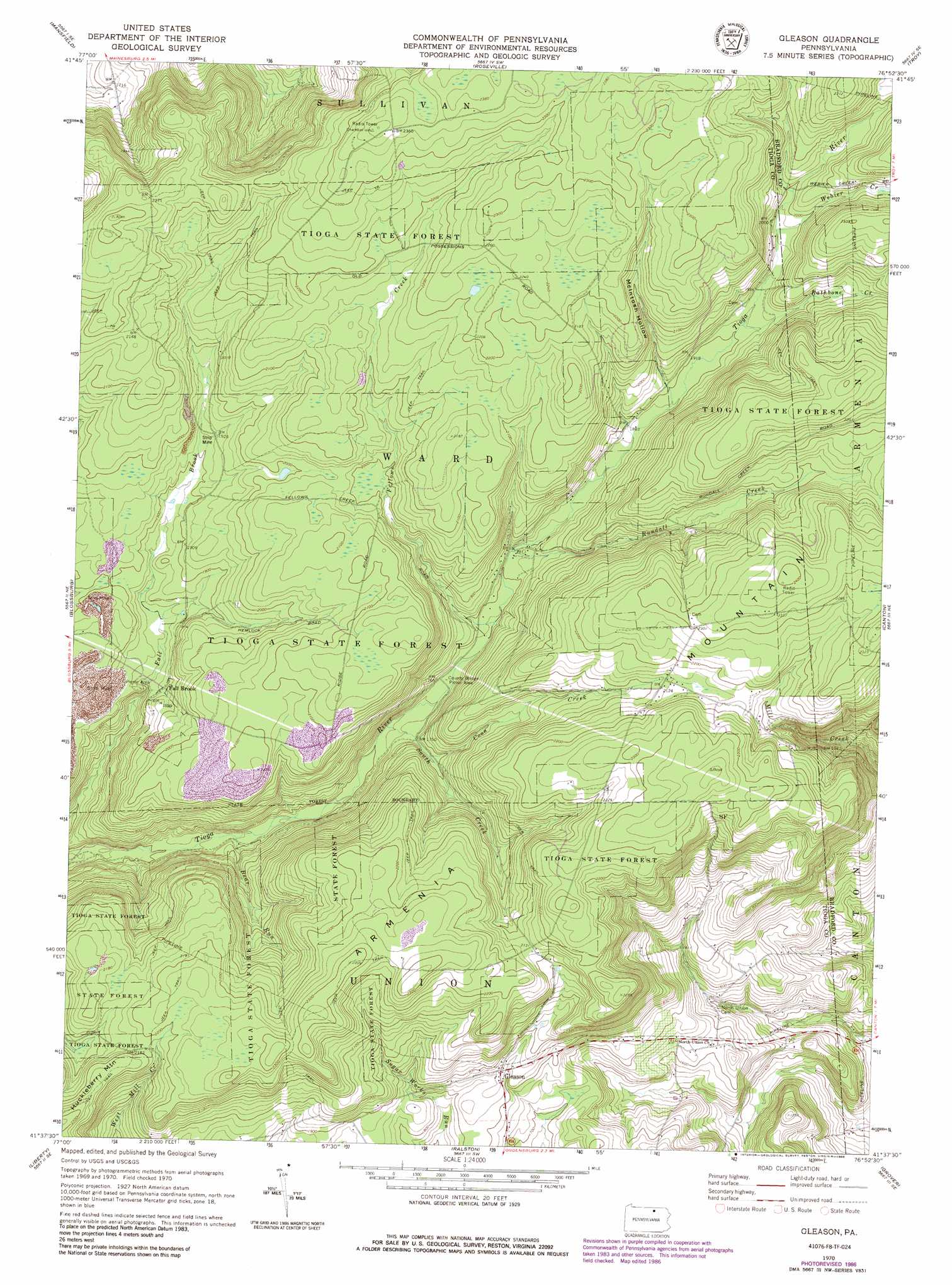
USGS Topo Quad 41076f8 - 1:24,000 scale
| Topo Map Name: | Gleason |
| USGS Topo Quad ID: | 41076f8 |
| Print Size: | ca. 21 1/4" wide x 27" high |
| Southeast Coordinates: | 41.625° N latitude / 76.875° W longitude |
| Map Center Coordinates: | 41.6875° N latitude / 76.9375° W longitude |
| U.S. State: | PA |
| Filename: | o41076f8.jpg |
| Download Map JPG Image: | Gleason topo map 1:24,000 scale |
| Map Type: | Topographic |
| Topo Series: | 7.5´ |
| Map Scale: | 1:24,000 |
| Source of Map Images: | United States Geological Survey (USGS) |
| Alternate Map Versions: |
Gleason PA 1970, updated 1972 Download PDF Buy paper map Gleason PA 1970, updated 1977 Download PDF Buy paper map Gleason PA 1970, updated 1986 Download PDF Buy paper map Gleason PA 1970, updated 1986 Download PDF Buy paper map Gleason PA 2010 Download PDF Buy paper map Gleason PA 2013 Download PDF Buy paper map Gleason PA 2016 Download PDF Buy paper map |
1:24,000 Topo Quads surrounding Gleason
Tioga |
Jackson Summit |
Millerton |
Gillett |
Bentley Creek |
Crooked Creek |
Mansfield |
Roseville |
Troy |
East Troy |
Cherry Flats |
Blossburg |
Gleason |
Canton |
Leroy |
Nauvoo |
Liberty |
Ralston |
Grover |
Shunk |
White Pine |
Trout Run |
Bodines |
Barbours |
Hillsgrove |
> Back to 41076e1 at 1:100,000 scale
> Back to 41076a1 at 1:250,000 scale
> Back to U.S. Topo Maps home
Gleason topo map: Gazetteer
Gleason: Falls
Fallbrook Falls elevation 544m 1784′Gleason: Populated Places
Fall Brook elevation 562m 1843′Gleason elevation 563m 1847′
Gleason: Streams
Bear Run elevation 502m 1646′Coon Creek elevation 542m 1778′
Fellows Creek elevation 541m 1774′
Rathbone Creek elevation 583m 1912′
Rundall Creek elevation 550m 1804′
South Creek elevation 521m 1709′
Webier Creek elevation 599m 1965′
Gleason: Summits
Armenia Mountain elevation 734m 2408′Gleason: Valleys
McIntosh Hollow elevation 585m 1919′Gleason digital topo map on disk
Buy this Gleason topo map showing relief, roads, GPS coordinates and other geographical features, as a high-resolution digital map file on DVD:
New York, Vermont, Connecticut & Western Massachusetts
Buy digital topo maps: New York, Vermont, Connecticut & Western Massachusetts