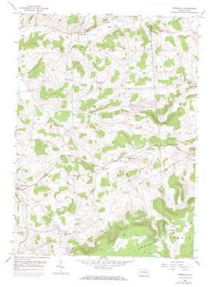
Roseville Topo Map Pennsylvania
To zoom in, hover over the map of Roseville
USGS Topo Quad 41076g8 - 1:24,000 scale
| Topo Map Name: | Roseville |
| USGS Topo Quad ID: | 41076g8 |
| Print Size: | ca. 21 1/4" wide x 27" high |
| Southeast Coordinates: | 41.75° N latitude / 76.875° W longitude |
| Map Center Coordinates: | 41.8125° N latitude / 76.9375° W longitude |
| U.S. State: | PA |
| Filename: | o41076g8.jpg |
| Download Map JPG Image: | Roseville topo map 1:24,000 scale |
| Map Type: | Topographic |
| Topo Series: | 7.5´ |
| Map Scale: | 1:24,000 |
| Source of Map Images: | United States Geological Survey (USGS) |
| Alternate Map Versions: |
Roseville PA 1953, updated 1954 Download PDF Buy paper map Roseville PA 1953, updated 1971 Download PDF Buy paper map Roseville PA 2010 Download PDF Buy paper map Roseville PA 2013 Download PDF Buy paper map Roseville PA 2016 Download PDF Buy paper map |
1:24,000 Topo Quads surrounding Roseville
> Back to 41076e1 at 1:100,000 scale
> Back to 41076a1 at 1:250,000 scale
> Back to U.S. Topo Maps home
Roseville topo map: Gazetteer
Roseville: Populated Places
Mainesburg elevation 425m 1394′Roseville elevation 413m 1354′
Roseville: Post Offices
Grays Valley Post Office (historical) elevation 458m 1502′Rutland Post Office (historical) elevation 420m 1377′
Roseville: Streams
Bear Creek elevation 419m 1374′Gaffers Creek elevation 480m 1574′
Roseville: Summits
Benson Knob elevation 568m 1863′Roseville digital topo map on disk
Buy this Roseville topo map showing relief, roads, GPS coordinates and other geographical features, as a high-resolution digital map file on DVD:
New York, Vermont, Connecticut & Western Massachusetts
Buy digital topo maps: New York, Vermont, Connecticut & Western Massachusetts


