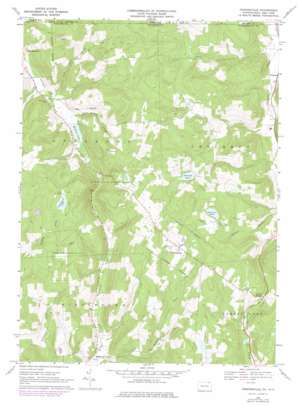
Friendsville Topo Map Pennsylvania
To zoom in, hover over the map of Friendsville
USGS Topo Quad 41076h1 - 1:24,000 scale
| Topo Map Name: | Friendsville |
| USGS Topo Quad ID: | 41076h1 |
| Print Size: | ca. 21 1/4" wide x 27" high |
| Southeast Coordinates: | 41.875° N latitude / 76° W longitude |
| Map Center Coordinates: | 41.9375° N latitude / 76.0625° W longitude |
| U.S. States: | PA, NY |
| Filename: | o41076h1.jpg |
| Download Map JPG Image: | Friendsville topo map 1:24,000 scale |
| Map Type: | Topographic |
| Topo Series: | 7.5´ |
| Map Scale: | 1:24,000 |
| Source of Map Images: | United States Geological Survey (USGS) |
| Alternate Map Versions: |
Friendsville PA 1967, updated 1971 Download PDF Buy paper map Friendsville PA 1967, updated 1978 Download PDF Buy paper map Friendsville PA 1967, updated 1978 Download PDF Buy paper map Friendsville PA 2010 Download PDF Buy paper map Friendsville PA 2013 Download PDF Buy paper map Friendsville PA 2016 Download PDF Buy paper map |
1:24,000 Topo Quads surrounding Friendsville
> Back to 41076e1 at 1:100,000 scale
> Back to 41076a1 at 1:250,000 scale
> Back to U.S. Topo Maps home
Friendsville topo map: Gazetteer
Friendsville: Dams
Minkler Lake Dam elevation 348m 1141′Stanley Lake Dam elevation 504m 1653′
Stone Lake Dam elevation 433m 1420′
Friendsville: Lakes
Carmault Lake elevation 500m 1640′Stanley Lake elevation 433m 1420′
Friendsville: Parks
State Game Lands Number 140 elevation 412m 1351′Friendsville: Populated Places
Friendsville elevation 473m 1551′Middletown Center elevation 301m 987′
Friendsville: Reservoirs
Choconut Lake elevation 476m 1561′Courtland Birchard Pond elevation 433m 1420′
Minkler Lake elevation 348m 1141′
Friendsville: Streams
Baldwin Creek elevation 298m 977′Bow Bridge Creek elevation 350m 1148′
Cork Hill Creek elevation 335m 1099′
Cork Hill Creek elevation 334m 1095′
Lee Creek elevation 305m 1000′
Friendsville: Summits
Cork Hill elevation 577m 1893′Friendsville digital topo map on disk
Buy this Friendsville topo map showing relief, roads, GPS coordinates and other geographical features, as a high-resolution digital map file on DVD:
New York, Vermont, Connecticut & Western Massachusetts
Buy digital topo maps: New York, Vermont, Connecticut & Western Massachusetts


