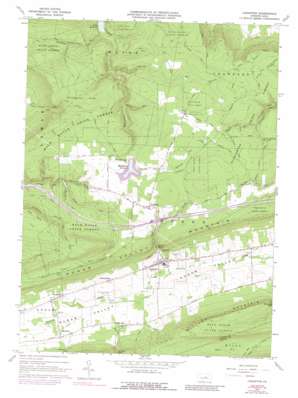
Loganton Topo Map Pennsylvania
To zoom in, hover over the map of Loganton
USGS Topo Quad 41077a3 - 1:24,000 scale
| Topo Map Name: | Loganton |
| USGS Topo Quad ID: | 41077a3 |
| Print Size: | ca. 21 1/4" wide x 27" high |
| Southeast Coordinates: | 41° N latitude / 77.25° W longitude |
| Map Center Coordinates: | 41.0625° N latitude / 77.3125° W longitude |
| U.S. State: | PA |
| Filename: | o41077a3.jpg |
| Download Map JPG Image: | Loganton topo map 1:24,000 scale |
| Map Type: | Topographic |
| Topo Series: | 7.5´ |
| Map Scale: | 1:24,000 |
| Source of Map Images: | United States Geological Survey (USGS) |
| Alternate Map Versions: |
Loganton PA 1965, updated 1966 Download PDF Buy paper map Loganton PA 1965, updated 1973 Download PDF Buy paper map Loganton PA 1965, updated 1988 Download PDF Buy paper map Loganton PA 2010 Download PDF Buy paper map Loganton PA 2013 Download PDF Buy paper map Loganton PA 2016 Download PDF Buy paper map |
1:24,000 Topo Quads surrounding Loganton
> Back to 41077a1 at 1:100,000 scale
> Back to 41076a1 at 1:250,000 scale
> Back to U.S. Topo Maps home
Loganton topo map: Gazetteer
Loganton: Areas
Rosecrans Bog Natural Area elevation 537m 1761′Loganton: Dams
Warren H Ohl Dam elevation 514m 1686′Loganton: Flats
Chestnut Flat elevation 524m 1719′Loganton: Populated Places
Booneville elevation 375m 1230′Greenburr elevation 385m 1263′
Loganton elevation 397m 1302′
Rosecrans elevation 518m 1699′
Schracktown elevation 395m 1295′
Loganton: Reservoirs
McElhattan Reservoir elevation 514m 1686′Warren H Ohl Reservoir elevation 506m 1660′
Loganton: Springs
Blue Spring elevation 359m 1177′Hall Spring (historical) elevation 548m 1797′
Kemmerer Spring elevation 379m 1243′
Sulphur Spring elevation 419m 1374′
Loganton: Streams
Bull Run elevation 385m 1263′Cooper Run elevation 403m 1322′
East Kammerdiner Run elevation 276m 905′
Jamison Run elevation 507m 1663′
Lucus Run elevation 293m 961′
Matter Run elevation 398m 1305′
Mill Creek elevation 372m 1220′
Pepper Run elevation 415m 1361′
Spring Run elevation 337m 1105′
Spruce Run elevation 391m 1282′
Tunis Run elevation 461m 1512′
Washburn Run elevation 403m 1322′
Loganton: Trails
Boiler Trail elevation 674m 2211′Erron Trail elevation 556m 1824′
Game Refuge Trail elevation 653m 2142′
Gardner Trail elevation 572m 1876′
Kammerdiner Cross Line Trail elevation 512m 1679′
Kemmerer Trail elevation 523m 1715′
Kettle Trail elevation 532m 1745′
Kyler Trail elevation 541m 1774′
Lerch Trail elevation 585m 1919′
Miller Trail elevation 511m 1676′
Nittany Mountain Trail elevation 599m 1965′
Parker Shanty Trail elevation 544m 1784′
Smeltz Pond Trail elevation 524m 1719′
Snead Hol Trail elevation 449m 1473′
Loganton: Valleys
Hall Hollow elevation 395m 1295′Hopple Hollow elevation 464m 1522′
Loganton digital topo map on disk
Buy this Loganton topo map showing relief, roads, GPS coordinates and other geographical features, as a high-resolution digital map file on DVD:
New York, Vermont, Connecticut & Western Massachusetts
Buy digital topo maps: New York, Vermont, Connecticut & Western Massachusetts


