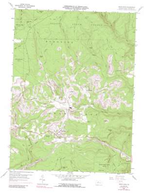
Snow Shoe Topo Map Pennsylvania
To zoom in, hover over the map of Snow Shoe
USGS Topo Quad 41077a8 - 1:24,000 scale
| Topo Map Name: | Snow Shoe |
| USGS Topo Quad ID: | 41077a8 |
| Print Size: | ca. 21 1/4" wide x 27" high |
| Southeast Coordinates: | 41° N latitude / 77.875° W longitude |
| Map Center Coordinates: | 41.0625° N latitude / 77.9375° W longitude |
| U.S. State: | PA |
| Filename: | o41077a8.jpg |
| Download Map JPG Image: | Snow Shoe topo map 1:24,000 scale |
| Map Type: | Topographic |
| Topo Series: | 7.5´ |
| Map Scale: | 1:24,000 |
| Source of Map Images: | United States Geological Survey (USGS) |
| Alternate Map Versions: |
Snow Shoe PA 1960, updated 1963 Download PDF Buy paper map Snow Shoe PA 1960, updated 1970 Download PDF Buy paper map Snow Shoe PA 1960, updated 1972 Download PDF Buy paper map Snow Shoe PA 1960, updated 1988 Download PDF Buy paper map Snow Shoe PA 1996, updated 1999 Download PDF Buy paper map Snow Shoe PA 2010 Download PDF Buy paper map Snow Shoe PA 2013 Download PDF Buy paper map Snow Shoe PA 2016 Download PDF Buy paper map |
1:24,000 Topo Quads surrounding Snow Shoe
> Back to 41077a1 at 1:100,000 scale
> Back to 41076a1 at 1:250,000 scale
> Back to U.S. Topo Maps home
Snow Shoe topo map: Gazetteer
Snow Shoe: Populated Places
Butts elevation 493m 1617′Cherry Run elevation 444m 1456′
Clarence elevation 427m 1400′
Fountain elevation 496m 1627′
Gillintown elevation 492m 1614′
Musellmans Crossing elevation 482m 1581′
Old Side elevation 444m 1456′
Pancake elevation 414m 1358′
Poorman Side elevation 457m 1499′
Rhoads elevation 521m 1709′
Shettleston elevation 408m 1338′
Snow Shoe elevation 470m 1541′
Snow Shoe: Reservoirs
Snow Shoe Reservoir elevation 540m 1771′Snow Shoe: Streams
Beauty Run elevation 400m 1312′Contrary Run elevation 438m 1437′
Dry Run elevation 505m 1656′
Hicklen Run elevation 417m 1368′
Horsehead Run elevation 487m 1597′
Jonathan Run elevation 431m 1414′
Little Sandy Run elevation 424m 1391′
Little Wolf Run elevation 370m 1213′
North Fork Beech Creek elevation 424m 1391′
Pine Run elevation 426m 1397′
Stinktown Run elevation 519m 1702′
Snow Shoe: Summits
Big Fork Hill elevation 609m 1998′Little Fork Hill elevation 587m 1925′
Tower Hill elevation 554m 1817′
Snow Shoe: Trails
Big Sandy Trail elevation 590m 1935′Dead Horse Trail elevation 559m 1833′
Rock Run Trail elevation 569m 1866′
Wolf Run Trail elevation 439m 1440′
Snow Shoe: Valleys
Dry Hollow elevation 417m 1368′Snow Shoe digital topo map on disk
Buy this Snow Shoe topo map showing relief, roads, GPS coordinates and other geographical features, as a high-resolution digital map file on DVD:
New York, Vermont, Connecticut & Western Massachusetts
Buy digital topo maps: New York, Vermont, Connecticut & Western Massachusetts


