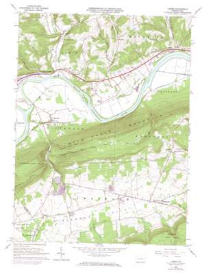
Linden Topo Map Pennsylvania
To zoom in, hover over the map of Linden
USGS Topo Quad 41077b2 - 1:24,000 scale
| Topo Map Name: | Linden |
| USGS Topo Quad ID: | 41077b2 |
| Print Size: | ca. 21 1/4" wide x 27" high |
| Southeast Coordinates: | 41.125° N latitude / 77.125° W longitude |
| Map Center Coordinates: | 41.1875° N latitude / 77.1875° W longitude |
| U.S. State: | PA |
| Filename: | o41077b2.jpg |
| Download Map JPG Image: | Linden topo map 1:24,000 scale |
| Map Type: | Topographic |
| Topo Series: | 7.5´ |
| Map Scale: | 1:24,000 |
| Source of Map Images: | United States Geological Survey (USGS) |
| Alternate Map Versions: |
Linden PA 1965, updated 1967 Download PDF Buy paper map Linden PA 1965, updated 1973 Download PDF Buy paper map Linden PA 2010 Download PDF Buy paper map Linden PA 2013 Download PDF Buy paper map Linden PA 2016 Download PDF Buy paper map |
1:24,000 Topo Quads surrounding Linden
> Back to 41077a1 at 1:100,000 scale
> Back to 41076a1 at 1:250,000 scale
> Back to U.S. Topo Maps home
Linden topo map: Gazetteer
Linden: Airports
Garrett Airport elevation 236m 774′Hinaman Acres Airport elevation 244m 800′
Jersey Shore Airport elevation 165m 541′
Toms Landing Strip elevation 153m 501′
Linden: Islands
Crane Island elevation 153m 501′Long Island elevation 163m 534′
Linden: Populated Places
Antes Fort elevation 179m 587′Bastress elevation 360m 1181′
Collomsville elevation 241m 790′
Larrys Creek elevation 176m 577′
Larryville elevation 170m 557′
Level Corner elevation 168m 551′
Linden elevation 168m 551′
Nippono Park (historical) elevation 170m 557′
Oriole elevation 222m 728′
Oval elevation 247m 810′
Pine Run elevation 195m 639′
Linden: Streams
Antes Creek elevation 156m 511′Big Run elevation 158m 518′
Canoe Run elevation 176m 577′
Larrys Creek elevation 156m 511′
Little Pine Run elevation 173m 567′
McMurrin Run elevation 225m 738′
Morgan Valley Run elevation 182m 597′
Pine Run elevation 155m 508′
Quenshukeny Run elevation 157m 515′
Rattling Camp Run elevation 246m 807′
Rauchtown Creek elevation 225m 738′
Seeley Run elevation 169m 554′
Stewards Run elevation 157m 515′
Linden digital topo map on disk
Buy this Linden topo map showing relief, roads, GPS coordinates and other geographical features, as a high-resolution digital map file on DVD:
New York, Vermont, Connecticut & Western Massachusetts
Buy digital topo maps: New York, Vermont, Connecticut & Western Massachusetts


