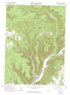
Trout Run Topo Map Pennsylvania
To zoom in, hover over the map of Trout Run
USGS Topo Quad 41077d1 - 1:24,000 scale
| Topo Map Name: | Trout Run |
| USGS Topo Quad ID: | 41077d1 |
| Print Size: | ca. 21 1/4" wide x 27" high |
| Southeast Coordinates: | 41.375° N latitude / 77° W longitude |
| Map Center Coordinates: | 41.4375° N latitude / 77.0625° W longitude |
| U.S. State: | PA |
| Filename: | o41077d1.jpg |
| Download Map JPG Image: | Trout Run topo map 1:24,000 scale |
| Map Type: | Topographic |
| Topo Series: | 7.5´ |
| Map Scale: | 1:24,000 |
| Source of Map Images: | United States Geological Survey (USGS) |
| Alternate Map Versions: |
Trout Run PA 1965, updated 1967 Download PDF Buy paper map Trout Run PA 1965, updated 1973 Download PDF Buy paper map Trout Run PA 1965, updated 1973 Download PDF Buy paper map Trout Run PA 2010 Download PDF Buy paper map Trout Run PA 2013 Download PDF Buy paper map Trout Run PA 2016 Download PDF Buy paper map |
1:24,000 Topo Quads surrounding Trout Run
> Back to 41077a1 at 1:100,000 scale
> Back to 41076a1 at 1:250,000 scale
> Back to U.S. Topo Maps home
Trout Run topo map: Gazetteer
Trout Run: Parks
State Game Lands Number 133 elevation 619m 2030′Trout Run: Populated Places
Caldwell elevation 213m 698′Gray elevation 219m 718′
Trout Run elevation 207m 679′
Trout Run: Ridges
Kinney Ridge elevation 472m 1548′Middle Ridge elevation 585m 1919′
Shriver Ridge elevation 575m 1886′
Trout Run: Streams
Dry Run elevation 250m 820′Glendenen Run elevation 206m 675′
Grays Run elevation 215m 705′
Hagerman Run elevation 209m 685′
Long Run elevation 367m 1204′
Long Run elevation 274m 898′
Shoemaker Run elevation 221m 725′
Short Run elevation 362m 1187′
Splash Dam Run elevation 307m 1007′
Steam Valley Run elevation 267m 875′
Trout Run elevation 200m 656′
Warm Run elevation 304m 997′
Trout Run: Summits
Bodine Mountain elevation 659m 2162′Cochran Mountain elevation 658m 2158′
Cornwell Mountain elevation 567m 1860′
Elk Knob elevation 622m 2040′
Green Mountain elevation 642m 2106′
Laurel Mountain elevation 707m 2319′
Narrow Mountain elevation 644m 2112′
Round Top elevation 585m 1919′
Sugarcamp Mountain elevation 653m 2142′
Trout Run: Valleys
Bartoff Hollow elevation 280m 918′Bear Hollow elevation 525m 1722′
Breeing Hollow elevation 247m 810′
Brown Hollow elevation 255m 836′
Deep Hollow elevation 364m 1194′
Elbow Hollow elevation 282m 925′
Fourmile Hollow elevation 314m 1030′
Holly Hollow elevation 490m 1607′
Pheasant Hollow elevation 499m 1637′
Pigeon Hollow elevation 375m 1230′
Reeder Hollow elevation 296m 971′
Skunk Hollow elevation 366m 1200′
Sugarcamp Hollow elevation 235m 770′
Turntable Hollow elevation 330m 1082′
Wren Hollow elevation 473m 1551′
Yoder Hollow elevation 396m 1299′
Trout Run digital topo map on disk
Buy this Trout Run topo map showing relief, roads, GPS coordinates and other geographical features, as a high-resolution digital map file on DVD:
New York, Vermont, Connecticut & Western Massachusetts
Buy digital topo maps: New York, Vermont, Connecticut & Western Massachusetts


