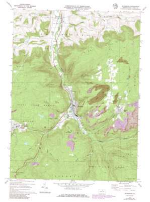
Blossburg Topo Map Pennsylvania
To zoom in, hover over the map of Blossburg
USGS Topo Quad 41077f1 - 1:24,000 scale
| Topo Map Name: | Blossburg |
| USGS Topo Quad ID: | 41077f1 |
| Print Size: | ca. 21 1/4" wide x 27" high |
| Southeast Coordinates: | 41.625° N latitude / 77° W longitude |
| Map Center Coordinates: | 41.6875° N latitude / 77.0625° W longitude |
| U.S. State: | PA |
| Filename: | o41077f1.jpg |
| Download Map JPG Image: | Blossburg topo map 1:24,000 scale |
| Map Type: | Topographic |
| Topo Series: | 7.5´ |
| Map Scale: | 1:24,000 |
| Source of Map Images: | United States Geological Survey (USGS) |
| Alternate Map Versions: |
Blossburg PA 1970, updated 1972 Download PDF Buy paper map Blossburg PA 1970, updated 1977 Download PDF Buy paper map Blossburg PA 1970, updated 1986 Download PDF Buy paper map Blossburg PA 1970, updated 1986 Download PDF Buy paper map Blossburg PA 2010 Download PDF Buy paper map Blossburg PA 2013 Download PDF Buy paper map Blossburg PA 2016 Download PDF Buy paper map |
1:24,000 Topo Quads surrounding Blossburg
> Back to 41077e1 at 1:100,000 scale
> Back to 41076a1 at 1:250,000 scale
> Back to U.S. Topo Maps home
Blossburg topo map: Gazetteer
Blossburg: Dams
Morris Run Mine Dam Number Three elevation 549m 1801′Blossburg: Parks
Helen Lutes Softball Field elevation 625m 2050′Blossburg: Populated Places
Arnot elevation 515m 1689′Blakes elevation 565m 1853′
Blossburg elevation 408m 1338′
Covington elevation 364m 1194′
Morris Run elevation 516m 1692′
Blossburg: Reservoirs
Morris Run Reservoir elevation 549m 1801′Blossburg: Streams
Bear Creek elevation 404m 1325′Bellman Run elevation 439m 1440′
Boone Run elevation 411m 1348′
Carpenter Run elevation 441m 1446′
Coal Creek elevation 415m 1361′
Dibble Run elevation 478m 1568′
East Creek Tioga River elevation 396m 1299′
Fall Brook elevation 466m 1528′
Flower Run elevation 466m 1528′
Johnson Creek elevation 405m 1328′
Long Run elevation 496m 1627′
Marvin Creek elevation 371m 1217′
Mills Creek elevation 420m 1377′
Morris Run elevation 424m 1391′
Sawmill Creek elevation 499m 1637′
Tan Creek elevation 369m 1210′
Taylor Run elevation 429m 1407′
Wilson Creek elevation 361m 1184′
Blossburg: Summits
Barneys Hill elevation 580m 1902′Huckleberry Mountain elevation 710m 2329′
Pig Hill elevation 554m 1817′
Pine Hill elevation 676m 2217′
South Mountain elevation 555m 1820′
Blossburg: Trails
Pig Hill Trail elevation 526m 1725′Blossburg: Valleys
Copp Hollow elevation 383m 1256′Frost Hollow elevation 395m 1295′
Limekiln Hollow elevation 396m 1299′
Blossburg digital topo map on disk
Buy this Blossburg topo map showing relief, roads, GPS coordinates and other geographical features, as a high-resolution digital map file on DVD:
New York, Vermont, Connecticut & Western Massachusetts
Buy digital topo maps: New York, Vermont, Connecticut & Western Massachusetts


