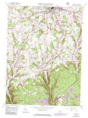
Antrim Topo Map Pennsylvania
To zoom in, hover over the map of Antrim
USGS Topo Quad 41077f3 - 1:24,000 scale
| Topo Map Name: | Antrim |
| USGS Topo Quad ID: | 41077f3 |
| Print Size: | ca. 21 1/4" wide x 27" high |
| Southeast Coordinates: | 41.625° N latitude / 77.25° W longitude |
| Map Center Coordinates: | 41.6875° N latitude / 77.3125° W longitude |
| U.S. State: | PA |
| Filename: | o41077f3.jpg |
| Download Map JPG Image: | Antrim topo map 1:24,000 scale |
| Map Type: | Topographic |
| Topo Series: | 7.5´ |
| Map Scale: | 1:24,000 |
| Source of Map Images: | United States Geological Survey (USGS) |
| Alternate Map Versions: |
Antrim PA 1946, updated 1963 Download PDF Buy paper map Antrim PA 1946, updated 1972 Download PDF Buy paper map Antrim PA 1946, updated 1973 Download PDF Buy paper map Antrim PA 1946, updated 1986 Download PDF Buy paper map Antrim PA 1946, updated 1986 Download PDF Buy paper map Antrim PA 1948, updated 1948 Download PDF Buy paper map Antrim PA 2010 Download PDF Buy paper map Antrim PA 2013 Download PDF Buy paper map Antrim PA 2016 Download PDF Buy paper map |
1:24,000 Topo Quads surrounding Antrim
> Back to 41077e1 at 1:100,000 scale
> Back to 41076a1 at 1:250,000 scale
> Back to U.S. Topo Maps home
Antrim topo map: Gazetteer
Antrim: Dams
Hamilton Lake Dam elevation 459m 1505′Kelsey Creek Dam Pa-600 elevation 428m 1404′
Lake Nessmuk Dam elevation 438m 1437′
Antrim: Populated Places
Antrim elevation 503m 1650′Balsam elevation 487m 1597′
Broughton Hollow elevation 446m 1463′
Brownlee elevation 561m 1840′
Coolidge Hollow elevation 469m 1538′
Draper elevation 410m 1345′
Duncan elevation 562m 1843′
Pitts elevation 414m 1358′
Roundtop elevation 478m 1568′
Stony Fork elevation 429m 1407′
Wellsboro elevation 396m 1299′
Williard elevation 505m 1656′
Antrim: Reservoirs
Hamilton Lake elevation 459m 1505′Kelsey Creek Lake elevation 428m 1404′
Lake Nessmuk elevation 438m 1437′
Antrim: Streams
Boyden Brook elevation 414m 1358′Hoover Brook elevation 402m 1318′
Johnson Run elevation 393m 1289′
Sand Run elevation 402m 1318′
Antrim: Summits
Dean Hill elevation 593m 1945′East Hill elevation 678m 2224′
Fork Point elevation 630m 2066′
Goat Ranch Hill elevation 683m 2240′
Lost Hill elevation 668m 2191′
Russell Hill elevation 585m 1919′
Shumway Hill elevation 592m 1942′
Antrim: Valleys
Boose Hollow elevation 433m 1420′Antrim digital topo map on disk
Buy this Antrim topo map showing relief, roads, GPS coordinates and other geographical features, as a high-resolution digital map file on DVD:
New York, Vermont, Connecticut & Western Massachusetts
Buy digital topo maps: New York, Vermont, Connecticut & Western Massachusetts


