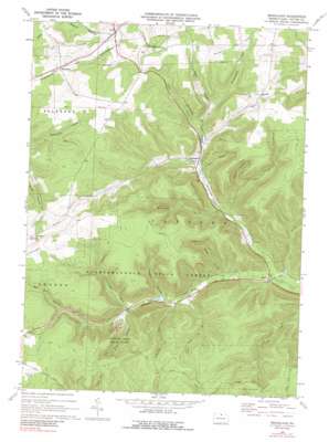
Brookland Topo Map Pennsylvania
To zoom in, hover over the map of Brookland
USGS Topo Quad 41077g7 - 1:24,000 scale
| Topo Map Name: | Brookland |
| USGS Topo Quad ID: | 41077g7 |
| Print Size: | ca. 21 1/4" wide x 27" high |
| Southeast Coordinates: | 41.75° N latitude / 77.75° W longitude |
| Map Center Coordinates: | 41.8125° N latitude / 77.8125° W longitude |
| U.S. State: | PA |
| Filename: | o41077g7.jpg |
| Download Map JPG Image: | Brookland topo map 1:24,000 scale |
| Map Type: | Topographic |
| Topo Series: | 7.5´ |
| Map Scale: | 1:24,000 |
| Source of Map Images: | United States Geological Survey (USGS) |
| Alternate Map Versions: |
Brookland PA 1969, updated 1972 Download PDF Buy paper map Brookland PA 1969, updated 1972 Download PDF Buy paper map Brookland PA 1969, updated 1988 Download PDF Buy paper map Brookland PA 1969, updated 1988 Download PDF Buy paper map Brookland PA 2010 Download PDF Buy paper map Brookland PA 2013 Download PDF Buy paper map Brookland PA 2016 Download PDF Buy paper map |
1:24,000 Topo Quads surrounding Brookland
> Back to 41077e1 at 1:100,000 scale
> Back to 41076a1 at 1:250,000 scale
> Back to U.S. Topo Maps home
Brookland topo map: Gazetteer
Brookland: Airports
Potato City Airport elevation 748m 2454′Brookland: Parks
Denton Hill State Park elevation 598m 1961′Brookland: Populated Places
Brookland elevation 543m 1781′Fox Hill elevation 716m 2349′
Gold elevation 639m 2096′
Newfield Junction elevation 701m 2299′
Raymond elevation 672m 2204′
Sweden elevation 703m 2306′
Walton elevation 490m 1607′
Brookland: Post Offices
Gaffnee Post Office (historical) elevation 481m 1578′Brookland: Streams
Barn Brook elevation 475m 1558′Buckseller Run elevation 511m 1676′
Commissioner Run elevation 548m 1797′
Dry Run elevation 517m 1696′
Jones Run elevation 519m 1702′
Ninemile Run elevation 479m 1571′
Brookland: Summits
Triple Divide elevation 769m 2522′Brookland: Trails
Big Fill Hollow Trail elevation 662m 2171′Brown Trail elevation 584m 1916′
Buckseller Run Trail elevation 575m 1886′
Commissioner Run Trail elevation 667m 2188′
Crowell Hollow Trail elevation 719m 2358′
Elm Hollow Trail elevation 601m 1971′
Losey Trail elevation 686m 2250′
Ridge Trail elevation 757m 2483′
Storey Trail elevation 729m 2391′
Township Trail elevation 663m 2175′
Brookland: Valleys
Big Fill Hollow elevation 626m 2053′Crowell Hollow elevation 536m 1758′
Ellis Hollow elevation 503m 1650′
Elm Hollow elevation 554m 1817′
Heath Hollow elevation 601m 1971′
Homestead Hollow elevation 596m 1955′
Mill Hollow elevation 543m 1781′
Raplee Hollow elevation 650m 2132′
Reese Hollow elevation 539m 1768′
Reese Hollow elevation 581m 1906′
Brookland digital topo map on disk
Buy this Brookland topo map showing relief, roads, GPS coordinates and other geographical features, as a high-resolution digital map file on DVD:
New York, Vermont, Connecticut & Western Massachusetts
Buy digital topo maps: New York, Vermont, Connecticut & Western Massachusetts


