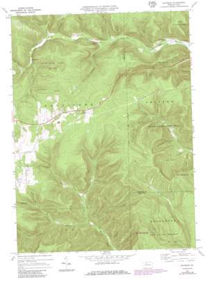
Rathbun Topo Map Pennsylvania
To zoom in, hover over the map of Rathbun
USGS Topo Quad 41078d4 - 1:24,000 scale
| Topo Map Name: | Rathbun |
| USGS Topo Quad ID: | 41078d4 |
| Print Size: | ca. 21 1/4" wide x 27" high |
| Southeast Coordinates: | 41.375° N latitude / 78.375° W longitude |
| Map Center Coordinates: | 41.4375° N latitude / 78.4375° W longitude |
| U.S. State: | PA |
| Filename: | o41078d4.jpg |
| Download Map JPG Image: | Rathbun topo map 1:24,000 scale |
| Map Type: | Topographic |
| Topo Series: | 7.5´ |
| Map Scale: | 1:24,000 |
| Source of Map Images: | United States Geological Survey (USGS) |
| Alternate Map Versions: |
Rathbun PA 1969, updated 1972 Download PDF Buy paper map Rathbun PA 1969, updated 1981 Download PDF Buy paper map Rathbun PA 1969, updated 1986 Download PDF Buy paper map Rathbun PA 2010 Download PDF Buy paper map Rathbun PA 2013 Download PDF Buy paper map Rathbun PA 2016 Download PDF Buy paper map |
1:24,000 Topo Quads surrounding Rathbun
> Back to 41078a1 at 1:100,000 scale
> Back to 41078a1 at 1:250,000 scale
> Back to U.S. Topo Maps home
Rathbun topo map: Gazetteer
Rathbun: Parks
State Game Lands Number 293 elevation 488m 1601′Rathbun: Populated Places
Beechwood elevation 387m 1269′Rathbun elevation 400m 1312′
Swissmont elevation 429m 1407′
Rathbun: Streams
Bear Run elevation 432m 1417′Bear Run elevation 405m 1328′
Frenchmans Branch elevation 503m 1650′
Hellfire Run elevation 424m 1391′
Lecker Run elevation 459m 1505′
Little Bear Run elevation 446m 1463′
North Fork West Creek elevation 415m 1361′
Rock Lick Run elevation 397m 1302′
Sand Lick Run elevation 399m 1309′
Sawdust Run elevation 393m 1289′
South Fork West Creek elevation 430m 1410′
Rathbun: Summits
Goetz Summit elevation 620m 2034′Rathbun: Valleys
Bell Hollow elevation 427m 1400′Big Basin Hollow elevation 444m 1456′
Friddle Hollow elevation 406m 1332′
Hoover Hollow elevation 390m 1279′
Jordan Hollow elevation 443m 1453′
Rakestraw Hollow elevation 454m 1489′
Reed Hollow elevation 384m 1259′
Schoolhouse Hollow elevation 412m 1351′
Seeley Hollow elevation 408m 1338′
Steinhopper Hollow elevation 453m 1486′
Sugar Bush Hollow elevation 487m 1597′
Warner Hollow elevation 399m 1309′
Rathbun digital topo map on disk
Buy this Rathbun topo map showing relief, roads, GPS coordinates and other geographical features, as a high-resolution digital map file on DVD:


