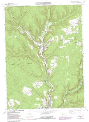
Wilcox Topo Map Pennsylvania
To zoom in, hover over the map of Wilcox
USGS Topo Quad 41078e6 - 1:24,000 scale
| Topo Map Name: | Wilcox |
| USGS Topo Quad ID: | 41078e6 |
| Print Size: | ca. 21 1/4" wide x 27" high |
| Southeast Coordinates: | 41.5° N latitude / 78.625° W longitude |
| Map Center Coordinates: | 41.5625° N latitude / 78.6875° W longitude |
| U.S. State: | PA |
| Filename: | o41078e6.jpg |
| Download Map JPG Image: | Wilcox topo map 1:24,000 scale |
| Map Type: | Topographic |
| Topo Series: | 7.5´ |
| Map Scale: | 1:24,000 |
| Source of Map Images: | United States Geological Survey (USGS) |
| Alternate Map Versions: |
Wilcox PA 1969, updated 1972 Download PDF Buy paper map Wilcox PA 1969, updated 1981 Download PDF Buy paper map Wilcox PA 1969, updated 1988 Download PDF Buy paper map Wilcox PA 2011 Download PDF Buy paper map Wilcox PA 2013 Download PDF Buy paper map Wilcox PA 2016 Download PDF Buy paper map |
| FStopo: | US Forest Service topo Wilcox is available: Download FStopo PDF Download FStopo TIF |
1:24,000 Topo Quads surrounding Wilcox
> Back to 41078e1 at 1:100,000 scale
> Back to 41078a1 at 1:250,000 scale
> Back to U.S. Topo Maps home
Wilcox topo map: Gazetteer
Wilcox: Oilfields
Mill Creek Oil and Gas Field elevation 605m 1984′Nansen Oil and Gas Field elevation 603m 1978′
Wilcox: Parks
Bendigo State Park elevation 455m 1492′Wilcox: Populated Places
Dahoga elevation 489m 1604′Ketner elevation 474m 1555′
Tambine elevation 453m 1486′
Wilcox elevation 465m 1525′
Wilcox: Streams
Bear Creek elevation 469m 1538′Bendigo Run elevation 451m 1479′
Hoffman Run elevation 481m 1578′
Indian Run elevation 444m 1456′
Johnson Run elevation 456m 1496′
Little Wolf Run elevation 448m 1469′
Long Run elevation 487m 1597′
Meffert Creek elevation 445m 1459′
Nearing Run elevation 467m 1532′
Oil Creek elevation 454m 1489′
Rocky Run elevation 472m 1548′
Slide Run elevation 488m 1601′
Wilson Run elevation 461m 1512′
Wolf Run elevation 452m 1482′
Wilcox digital topo map on disk
Buy this Wilcox topo map showing relief, roads, GPS coordinates and other geographical features, as a high-resolution digital map file on DVD:


