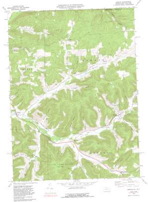
Oswayo Topo Map Pennsylvania
To zoom in, hover over the map of Oswayo
USGS Topo Quad 41078h1 - 1:24,000 scale
| Topo Map Name: | Oswayo |
| USGS Topo Quad ID: | 41078h1 |
| Print Size: | ca. 21 1/4" wide x 27" high |
| Southeast Coordinates: | 41.875° N latitude / 78° W longitude |
| Map Center Coordinates: | 41.9375° N latitude / 78.0625° W longitude |
| U.S. States: | PA, NY |
| Filename: | o41078h1.jpg |
| Download Map JPG Image: | Oswayo topo map 1:24,000 scale |
| Map Type: | Topographic |
| Topo Series: | 7.5´ |
| Map Scale: | 1:24,000 |
| Source of Map Images: | United States Geological Survey (USGS) |
| Alternate Map Versions: |
Oswayo PA 1969, updated 1972 Download PDF Buy paper map Oswayo PA 1969, updated 1981 Download PDF Buy paper map Oswayo PA 1969, updated 1988 Download PDF Buy paper map Oswayo PA 1969, updated 1988 Download PDF Buy paper map Oswayo PA 2010 Download PDF Buy paper map Oswayo PA 2013 Download PDF Buy paper map Oswayo PA 2016 Download PDF Buy paper map |
1:24,000 Topo Quads surrounding Oswayo
> Back to 41078e1 at 1:100,000 scale
> Back to 41078a1 at 1:250,000 scale
> Back to U.S. Topo Maps home
Oswayo topo map: Gazetteer
Oswayo: Airports
Adams Airport elevation 540m 1771′Oswayo: Oilfields
Sharon Oil and Gas Field elevation 651m 2135′Oswayo: Populated Places
Chrystal elevation 566m 1856′Clara elevation 502m 1646′
Coneville elevation 492m 1614′
Hebron Center elevation 546m 1791′
Kibbeville elevation 603m 1978′
Millport elevation 470m 1541′
Oswayo elevation 518m 1699′
Oswayo: Streams
Bradley Run elevation 501m 1643′Canada Run elevation 469m 1538′
Clara Creek elevation 480m 1574′
Elevenmile Creek elevation 471m 1545′
Hemlock Hollow Run elevation 523m 1715′
South Branch Oswayo Creek elevation 488m 1601′
Topeka Creek elevation 482m 1581′
West Branch Whitney Creek elevation 506m 1660′
Whitney Creek elevation 500m 1640′
Oswayo: Valleys
Big Hollow elevation 549m 1801′Brizzee Hollow elevation 536m 1758′
Bryant Hollow elevation 522m 1712′
Bunker Hollow elevation 542m 1778′
Collins Hollow elevation 540m 1771′
Deering Hollow elevation 499m 1637′
Dwight Hollow elevation 509m 1669′
Estes Hollow elevation 511m 1676′
Gilmore Hollow elevation 513m 1683′
Grover Hollow elevation 542m 1778′
Herring Hollow elevation 489m 1604′
Hollenback Hollow elevation 530m 1738′
Lawson Hollow elevation 536m 1758′
Long Hollow elevation 544m 1784′
Ross Hollow elevation 488m 1601′
Straight Hollow elevation 502m 1646′
Toad Hollow elevation 517m 1696′
Tyler Hollow elevation 509m 1669′
Walman Nichlos Hollow elevation 484m 1587′
Wokeley Hollow elevation 512m 1679′
Oswayo digital topo map on disk
Buy this Oswayo topo map showing relief, roads, GPS coordinates and other geographical features, as a high-resolution digital map file on DVD:


