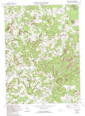
Coolspring Topo Map Pennsylvania
To zoom in, hover over the map of Coolspring
USGS Topo Quad 41079a1 - 1:24,000 scale
| Topo Map Name: | Coolspring |
| USGS Topo Quad ID: | 41079a1 |
| Print Size: | ca. 21 1/4" wide x 27" high |
| Southeast Coordinates: | 41° N latitude / 79° W longitude |
| Map Center Coordinates: | 41.0625° N latitude / 79.0625° W longitude |
| U.S. State: | PA |
| Filename: | o41079a1.jpg |
| Download Map JPG Image: | Coolspring topo map 1:24,000 scale |
| Map Type: | Topographic |
| Topo Series: | 7.5´ |
| Map Scale: | 1:24,000 |
| Source of Map Images: | United States Geological Survey (USGS) |
| Alternate Map Versions: |
Coolspring PA 1969, updated 1972 Download PDF Buy paper map Coolspring PA 1969, updated 1982 Download PDF Buy paper map Coolspring PA 1969, updated 1992 Download PDF Buy paper map Coolspring PA 1969, updated 1994 Download PDF Buy paper map Coolspring PA 1969, updated 1994 Download PDF Buy paper map Coolspring PA 2010 Download PDF Buy paper map Coolspring PA 2013 Download PDF Buy paper map Coolspring PA 2016 Download PDF Buy paper map |
1:24,000 Topo Quads surrounding Coolspring
> Back to 41079a1 at 1:100,000 scale
> Back to 41078a1 at 1:250,000 scale
> Back to U.S. Topo Maps home
Coolspring topo map: Gazetteer
Coolspring: Parks
State Game Lands Number 31 elevation 553m 1814′Coolspring: Populated Places
Barnes elevation 414m 1358′Colon elevation 442m 1450′
Coolspring elevation 381m 1250′
Coulter elevation 444m 1456′
East Branch elevation 397m 1302′
Green Valley elevation 439m 1440′
Iowa elevation 392m 1286′
Knox Dale elevation 515m 1689′
Markton elevation 509m 1669′
McGarey elevation 437m 1433′
Norman elevation 433m 1420′
Ramsaytown elevation 473m 1551′
Sprankle Mills elevation 373m 1223′
Stanton elevation 483m 1584′
Tait elevation 485m 1591′
Coolspring: Streams
Clutch Run elevation 414m 1358′Hadden Run elevation 427m 1400′
Hickok Run elevation 426m 1397′
Hunts Run elevation 404m 1325′
Indiancamp Run elevation 394m 1292′
Lick Run elevation 373m 1223′
Middle Branch Little Sandy Creek elevation 435m 1427′
Smathers Run elevation 415m 1361′
Coolspring digital topo map on disk
Buy this Coolspring topo map showing relief, roads, GPS coordinates and other geographical features, as a high-resolution digital map file on DVD:


