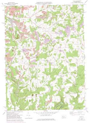
Sligo Topo Map Pennsylvania
To zoom in, hover over the map of Sligo
USGS Topo Quad 41079a4 - 1:24,000 scale
| Topo Map Name: | Sligo |
| USGS Topo Quad ID: | 41079a4 |
| Print Size: | ca. 21 1/4" wide x 27" high |
| Southeast Coordinates: | 41° N latitude / 79.375° W longitude |
| Map Center Coordinates: | 41.0625° N latitude / 79.4375° W longitude |
| U.S. State: | PA |
| Filename: | o41079a4.jpg |
| Download Map JPG Image: | Sligo topo map 1:24,000 scale |
| Map Type: | Topographic |
| Topo Series: | 7.5´ |
| Map Scale: | 1:24,000 |
| Source of Map Images: | United States Geological Survey (USGS) |
| Alternate Map Versions: |
Sligo PA 1969, updated 1972 Download PDF Buy paper map Sligo PA 1969, updated 1982 Download PDF Buy paper map Sligo PA 1969, updated 1982 Download PDF Buy paper map Sligo PA 2010 Download PDF Buy paper map Sligo PA 2013 Download PDF Buy paper map Sligo PA 2016 Download PDF Buy paper map |
1:24,000 Topo Quads surrounding Sligo
> Back to 41079a1 at 1:100,000 scale
> Back to 41078a1 at 1:250,000 scale
> Back to U.S. Topo Maps home
Sligo topo map: Gazetteer
Sligo: Mines
Acme Mines (historical) elevation 389m 1276′Jocelyn Mine (historical) elevation 420m 1377′
Keystone Mine (historical) elevation 337m 1105′
Sligo: Populated Places
Churchville elevation 389m 1276′Curllsville elevation 367m 1204′
Diamond elevation 345m 1131′
Five Points elevation 383m 1256′
Frostburg elevation 400m 1312′
Leatherwood elevation 377m 1236′
Piolett elevation 434m 1423′
Rockville elevation 375m 1230′
Saint Charles Furnace elevation 359m 1177′
Sligo elevation 351m 1151′
Smithland elevation 458m 1502′
Squirrel Hill elevation 464m 1522′
Wildcat elevation 353m 1158′
Sligo: Ridges
Chestnut Ridge elevation 462m 1515′Sligo: Streams
Craggs Run elevation 352m 1154′Fiddlers Run elevation 321m 1053′
Jack Run elevation 370m 1213′
Little Licking Creek elevation 334m 1095′
Middle Run elevation 306m 1003′
Mineral Run elevation 337m 1105′
West Fork Leatherwood Creek elevation 388m 1272′
Wildcat Run East Fork elevation 350m 1148′
Sligo: Summits
McClays Peak elevation 429m 1407′Myers Hill elevation 479m 1571′
Sligo digital topo map on disk
Buy this Sligo topo map showing relief, roads, GPS coordinates and other geographical features, as a high-resolution digital map file on DVD:


