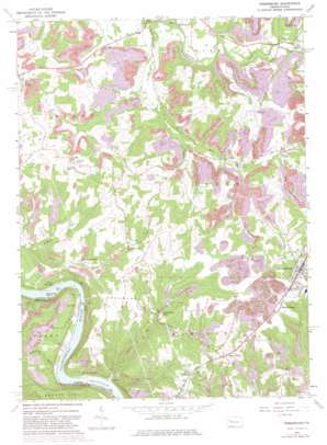
Rimersburg Topo Map Pennsylvania
To zoom in, hover over the map of Rimersburg
USGS Topo Quad 41079a5 - 1:24,000 scale
| Topo Map Name: | Rimersburg |
| USGS Topo Quad ID: | 41079a5 |
| Print Size: | ca. 21 1/4" wide x 27" high |
| Southeast Coordinates: | 41° N latitude / 79.5° W longitude |
| Map Center Coordinates: | 41.0625° N latitude / 79.5625° W longitude |
| U.S. State: | PA |
| Filename: | o41079a5.jpg |
| Download Map JPG Image: | Rimersburg topo map 1:24,000 scale |
| Map Type: | Topographic |
| Topo Series: | 7.5´ |
| Map Scale: | 1:24,000 |
| Source of Map Images: | United States Geological Survey (USGS) |
| Alternate Map Versions: |
Rimersburg PA 1963, updated 1965 Download PDF Buy paper map Rimersburg PA 1963, updated 1973 Download PDF Buy paper map Rimersburg PA 1963, updated 1982 Download PDF Buy paper map Rimersburg PA 2010 Download PDF Buy paper map Rimersburg PA 2013 Download PDF Buy paper map Rimersburg PA 2016 Download PDF Buy paper map |
1:24,000 Topo Quads surrounding Rimersburg
> Back to 41079a1 at 1:100,000 scale
> Back to 41078a1 at 1:250,000 scale
> Back to U.S. Topo Maps home
Rimersburg topo map: Gazetteer
Rimersburg: Islands
Bald Eagle Island elevation 251m 823′Rimersburg: Populated Places
Bela elevation 405m 1328′Catfish elevation 258m 846′
Hillville elevation 263m 862′
Huey elevation 385m 1263′
Kissingers Mill elevation 366m 1200′
Lower Hillville elevation 431m 1414′
Maple Grove elevation 449m 1473′
Mount Airy elevation 435m 1427′
New Athens elevation 420m 1377′
Rimersburg elevation 453m 1486′
Sandy Hollow elevation 434m 1423′
Sarah Furnace elevation 268m 879′
Toby elevation 357m 1171′
Upper Hillville elevation 269m 882′
West Freedom elevation 386m 1266′
Rimersburg: Post Offices
Fredell Post Office (historical) elevation 269m 882′Rimersburg: Streams
Anderson Run elevation 340m 1115′Armstrong Run elevation 249m 816′
Birch Run elevation 257m 843′
Catfish Run elevation 251m 823′
Cherry Run elevation 310m 1017′
Fiddlers Run elevation 328m 1076′
Rimersburg digital topo map on disk
Buy this Rimersburg topo map showing relief, roads, GPS coordinates and other geographical features, as a high-resolution digital map file on DVD:


