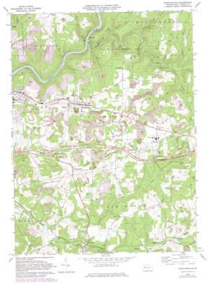
Strattanville Topo Map Pennsylvania
To zoom in, hover over the map of Strattanville
USGS Topo Quad 41079b3 - 1:24,000 scale
| Topo Map Name: | Strattanville |
| USGS Topo Quad ID: | 41079b3 |
| Print Size: | ca. 21 1/4" wide x 27" high |
| Southeast Coordinates: | 41.125° N latitude / 79.25° W longitude |
| Map Center Coordinates: | 41.1875° N latitude / 79.3125° W longitude |
| U.S. State: | PA |
| Filename: | o41079b3.jpg |
| Download Map JPG Image: | Strattanville topo map 1:24,000 scale |
| Map Type: | Topographic |
| Topo Series: | 7.5´ |
| Map Scale: | 1:24,000 |
| Source of Map Images: | United States Geological Survey (USGS) |
| Alternate Map Versions: |
Strattanville PA 1968, updated 1972 Download PDF Buy paper map Strattanville PA 1968, updated 1982 Download PDF Buy paper map Strattanville PA 2010 Download PDF Buy paper map Strattanville PA 2013 Download PDF Buy paper map Strattanville PA 2016 Download PDF Buy paper map |
1:24,000 Topo Quads surrounding Strattanville
> Back to 41079a1 at 1:100,000 scale
> Back to 41078a1 at 1:250,000 scale
> Back to U.S. Topo Maps home
Strattanville topo map: Gazetteer
Strattanville: Parks
State Game Lands Number 74 elevation 431m 1414′Strattanville: Populated Places
Day elevation 500m 1640′Henderson elevation 469m 1538′
Kingsville elevation 424m 1391′
Limestone elevation 395m 1295′
Mechanicsville elevation 440m 1443′
Rader elevation 466m 1528′
Stone House elevation 422m 1384′
Strattanville elevation 467m 1532′
Waterson elevation 477m 1564′
Strattanville: Post Offices
Frampton Post Office (historical) elevation 440m 1443′Limestone Post Office (historical) elevation 409m 1341′
Showers Post Office (historical) elevation 474m 1555′
Strattanville: Streams
Douglass Run elevation 388m 1272′Glade Run elevation 400m 1312′
Jones Run elevation 389m 1276′
Little Mill Creek elevation 390m 1279′
Little Piney Creek elevation 372m 1220′
McGourvey Run elevation 332m 1089′
Mill Creek elevation 332m 1089′
Poe Run elevation 418m 1371′
Reed Run elevation 332m 1089′
Sloan Run elevation 373m 1223′
Stroup Run elevation 354m 1161′
Tarkiln Run elevation 349m 1145′
Trap Run elevation 358m 1174′
Whites Run elevation 338m 1108′
Woods Run elevation 373m 1223′
Strattanville digital topo map on disk
Buy this Strattanville topo map showing relief, roads, GPS coordinates and other geographical features, as a high-resolution digital map file on DVD:


