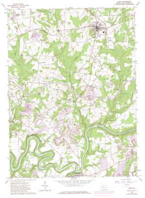
Knox Topo Map Pennsylvania
To zoom in, hover over the map of Knox
USGS Topo Quad 41079b5 - 1:24,000 scale
| Topo Map Name: | Knox |
| USGS Topo Quad ID: | 41079b5 |
| Print Size: | ca. 21 1/4" wide x 27" high |
| Southeast Coordinates: | 41.125° N latitude / 79.5° W longitude |
| Map Center Coordinates: | 41.1875° N latitude / 79.5625° W longitude |
| U.S. State: | PA |
| Filename: | o41079b5.jpg |
| Download Map JPG Image: | Knox topo map 1:24,000 scale |
| Map Type: | Topographic |
| Topo Series: | 7.5´ |
| Map Scale: | 1:24,000 |
| Source of Map Images: | United States Geological Survey (USGS) |
| Alternate Map Versions: |
Knox PA 1963, updated 1965 Download PDF Buy paper map Knox PA 1963, updated 1973 Download PDF Buy paper map Knox PA 1963, updated 1980 Download PDF Buy paper map Knox PA 1963, updated 1980 Download PDF Buy paper map Knox PA 2010 Download PDF Buy paper map Knox PA 2013 Download PDF Buy paper map Knox PA 2016 Download PDF Buy paper map |
1:24,000 Topo Quads surrounding Knox
> Back to 41079a1 at 1:100,000 scale
> Back to 41078a1 at 1:250,000 scale
> Back to U.S. Topo Maps home
Knox topo map: Gazetteer
Knox: Populated Places
Alum Rock elevation 335m 1099′Beaver City elevation 441m 1446′
Blairs Corners elevation 368m 1207′
Callensburg elevation 340m 1115′
Canoe Furnace elevation 404m 1325′
Easton elevation 348m 1141′
Elk City elevation 450m 1476′
Jefferson elevation 435m 1427′
Knox elevation 424m 1391′
Mongtown elevation 418m 1371′
Monroe elevation 449m 1473′
Pilgrimham elevation 447m 1466′
Snively Corners elevation 442m 1450′
Stovers Mill elevation 295m 967′
Turkey City elevation 366m 1200′
Turnip Hole elevation 355m 1164′
Wentlings Corners elevation 450m 1476′
Zion Hill elevation 423m 1387′
Knox: Post Offices
Alum Rock Post Office (historical) elevation 335m 1099′Knox: Rapids
Canoe Ripple elevation 319m 1046′Knox: Streams
Beaver Creek elevation 301m 987′Canoe Creek elevation 305m 1000′
Licking Creek elevation 299m 980′
Knox digital topo map on disk
Buy this Knox topo map showing relief, roads, GPS coordinates and other geographical features, as a high-resolution digital map file on DVD:


