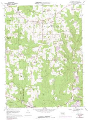
Fryburg Topo Map Pennsylvania
To zoom in, hover over the map of Fryburg
USGS Topo Quad 41079c4 - 1:24,000 scale
| Topo Map Name: | Fryburg |
| USGS Topo Quad ID: | 41079c4 |
| Print Size: | ca. 21 1/4" wide x 27" high |
| Southeast Coordinates: | 41.25° N latitude / 79.375° W longitude |
| Map Center Coordinates: | 41.3125° N latitude / 79.4375° W longitude |
| U.S. State: | PA |
| Filename: | o41079c4.jpg |
| Download Map JPG Image: | Fryburg topo map 1:24,000 scale |
| Map Type: | Topographic |
| Topo Series: | 7.5´ |
| Map Scale: | 1:24,000 |
| Source of Map Images: | United States Geological Survey (USGS) |
| Alternate Map Versions: |
Fryburg PA 1967, updated 1971 Download PDF Buy paper map Fryburg PA 1967, updated 1973 Download PDF Buy paper map Fryburg PA 1967, updated 1988 Download PDF Buy paper map Fryburg PA 1967, updated 1988 Download PDF Buy paper map Fryburg PA 2010 Download PDF Buy paper map Fryburg PA 2013 Download PDF Buy paper map Fryburg PA 2016 Download PDF Buy paper map |
1:24,000 Topo Quads surrounding Fryburg
> Back to 41079a1 at 1:100,000 scale
> Back to 41078a1 at 1:250,000 scale
> Back to U.S. Topo Maps home
Fryburg topo map: Gazetteer
Fryburg: Populated Places
Arthurs elevation 463m 1519′Fryburg elevation 520m 1706′
Huefner elevation 400m 1312′
Iron City elevation 434m 1423′
Marble elevation 478m 1568′
McCauley elevation 482m 1581′
Millerstown elevation 476m 1561′
Paint Mills elevation 459m 1505′
Shippenville elevation 420m 1377′
Strobleton elevation 490m 1607′
Venus elevation 487m 1597′
Fryburg: Springs
Huefner Spring elevation 407m 1335′Fryburg: Streams
Cooper Run elevation 365m 1197′Judith Run elevation 404m 1325′
Lauer Run elevation 401m 1315′
Licking Creek elevation 393m 1289′
Little Deer Creek elevation 390m 1279′
Little Paint Creek elevation 367m 1204′
Mahles Run elevation 387m 1269′
Mahles Run elevation 368m 1207′
Richland Run elevation 444m 1456′
Step Run elevation 399m 1309′
Stony Run elevation 368m 1207′
Fryburg digital topo map on disk
Buy this Fryburg topo map showing relief, roads, GPS coordinates and other geographical features, as a high-resolution digital map file on DVD:


